Sunday, December 20, 2015
Global Model Forecasts Very different For End Of Week
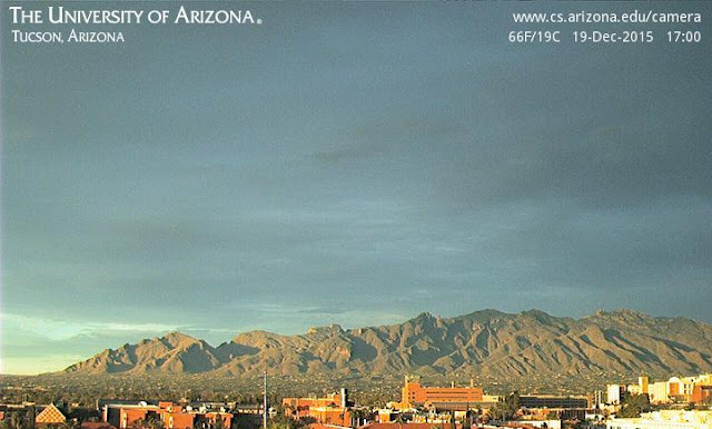
First, the heavy cloud cover yesterday persisted for almost all of the day, resulting in warmer morning temperatures and lower afternoon highs than were expected. For example, lows were 34 F here and 44 F at TUS - both about 10 F warmer than the previous morning. Campus webcam view of Catalinas at 5:00 pm MST yesterday shows a bit of sunshine just peeking through as the sun sets.
Now for the global model forecasts from the ECMWF and the NWS GFS. The forecasts shown here are at 144-hours from last evening and are all valid at 5:00 pm Christmas afternoon.
The ECMWF forecasts for 500 mb and surface pressure with 1000-500 mb thickness are shown above. Beginning yesterday the ECMWF products were morphing toward a forecast of a very progressive short wave moving across the Southwest - as per above. This leads to a rapid cold front coming by here on Christmas Eve (perhaps with showers) and a developing blizzard for parts of the High and Northern Plains.
In contrast the GFS (same two forecasts below) forecasts a system that has the northern portion shearing eastward, while a closed low develops over the Southwest for Saturday. The GFS forecasts only a weak, inverted pressure trough over West Texas for Christmas Day.
Note that the two models forecast significantly different ridge configurations along the West Coast, as well the resultant downstream amplification. The GFS seems to have been lagging behind the ECMWF forecast trends by about 24 - 36 hours, so I would lean toward the ECMWF forecasts for the weekend. Will look at the GFS plumes in the next post.
Subscribe to:
Post Comments (Atom)


No comments:
Post a Comment