Sunday, May 01, 2016
April Ends With A Trace
Stratus above washes over south end of Kitt Peak at 7:00 am MST this morning. There was considerable thunderstorm activity over Arizona yesterday - below is 24-hour hour flash density ending at 7:00 am (from weather.graphics and Vaisala). We had a few sprinkles here at the house yesterday afternoon, and have ended April with a Trace. There were 7 ALERT stations on the north side of the Catalinas that had measurable rainfall - max amount was 0.16".
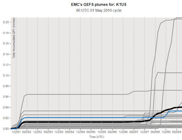
The GEFS QPF plumes from 06 UTC last night (above) are a bit all over the place - both for today and also for next weekend. Today there is a bit of CAPE again, and the WRF forecasts from Atmo at 06 UTC both forecast some light showers for spots in eastern Pima County.
By next weekend the GEFS 500 mb mean and spaghetti plot (below, valid at 5:00 pm MST Saturday) forecast another blocking pattern with a deep cyclone over the Southwest. So, another interesting situation on tap.
Subscribe to:
Post Comments (Atom)


No comments:
Post a Comment