
Smoke from the Bighorn fire resulted in a strange, orange sunrise this morning - above and second below.
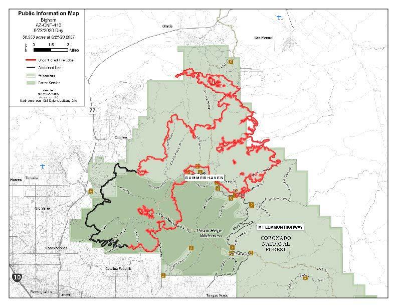
Current map below indicates fire has burned across much of the wilderness and National Forest areas of the Catalinas. Some reports this morning indicate current area burned at over 50,000 acres and that the fire is less than 20% contained.


As for rain hopes - long term model forecasts indicate a start to the summer thunderstorm during the first week in July - fairly typical timing. Shown above is 00 UTC GFS forecast for precipitation through midnight the night of June 30th, with only light amounts for mountains of southeast Arizona. However, by the 7th of July the 500 mb anticyclone (below) is well positioned for moisture return and increased thunderstorm activity. The GFS forecast indicates this in its forecast of total rainfall through midnight on the 6th of July - bottom - which indicates increased storm activity after July 1st.


No comments:
Post a Comment