Colorful skies this morning with tints of red to purple on the heavy cloud cover before sunrise - view of Catalinas above and of Rincons at bottom..
The models continue to forecast two distinct rain events, after the weekend, on Monday and Tuesday night. Plumes above are for QPF at the airport.
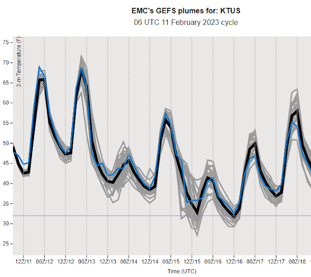
The 06 UTC plumes for temperature above indicate strong cooling for Monday, followed by near freezing temperatures on Wednesday. This will be quite a change following our mild weekend. Periods of strong and gusty winds will continue, especially Tuesday and Wednesday, as per plumes below.
Forecast above (from the 06 UTC WRF-GFS) is for precipitation amounts during the first precipitation event (ending at 11:00 pm MST Monday night).
Current morning forecast from the NWS Tucson forecast Office (below) indicates highest POPs Monday and then Tuesday night. Note the inclusion of a chance for snow during the second event on Tuesday night.


No comments:
Post a Comment