
ALERT rainfall observations for Monday. Amounts were mostly light, except for on the north side of the Catalinas. We had a total here of 0.14 inches.


View of the Catalinas at 9:00 am MST this morning (Wednesday the 15th), showing light snow cover on the mountains. Down at bottom, image shows snow falling at Bisbee at 7:00 am this morning.
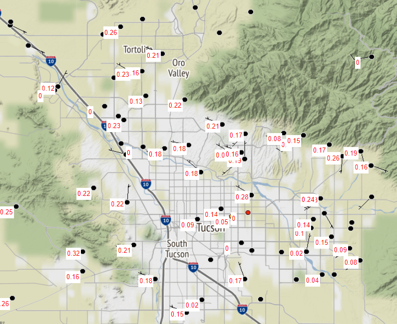
Observations of rainfall (above) from Mesowest at Univ. of Utah for 24 hours ending at 9:00 am this morning. Note that precipitation turned to snow during the early morning hours today, and most places had more precipitation than indicated. Here at house there was 0.12" in gauge at 9:00 am, but funnel was nearly full of snow. I won't know total until all the snow melts later this morning.

System that brought the snow was centered well north of here. Image above shows IR satellite imagery at 14:00 UTC, while 12 UTC 500 mb analysis is shown below. Wind speeds exceeded 100 knots around the base of the low. The morning sounding from TWC/TUS (second below) indicates max wind speeds around 130 knots. This system will be a prolific snow producer as it moves toward the Great Lakes Region.


No comments:
Post a Comment