Monday, July 25, 2022

Significant Rains Yesterday


Heavy storms over the western Catalinas at 3:30 pm MST yesterday afternoon. Down at bottom is view at 6:26 am this morning.

Plot of detected CG flashes (above for 24-hours ending at 0753 UTC last night) shows a distinct donut hole over much of the metro area.

However, data from the ALERT network (above and below) shows that rains of at least 0.04" occurred at a high percentage of the sites. Note the very heavy amounts over the eastern Catalinas. The 4.92" at Pima Canyon near Table Mountain occurred between 2:30 and 4:30 pm. Here at house showers from 3:00 to 5:00 pm totaled 0.45" - making the total here for day 0.64". This was most rain since the event of 1 July. The airport reported thunder with gusts to 40 mph, but only 0.02".


This morning's TWC/TUS sounding (above) remains moist with a bit of CAPE. The winds are light southerly below 300 mb, with stronger east winds above that. Difficult forecast today - the shallow surface layer could heat out, producing a new but shallow BL that would have a significant cap - or, significant heating could mix the BL out to 700 mb, but there would then be little CAPE.

The WRF forecast runs are not consistent - some runs produce almost no rain in Pima County today; while other runs forecast heavy storms in the metro area during the evening and night.

 The NWS morning forecast (below) keeps POPs high with heavy rains and a Flash Flood Watch. I would lean toward a mostly down day, i.e., a typical scenario after widespread rains.


Sunday, July 24, 2022

Active Night


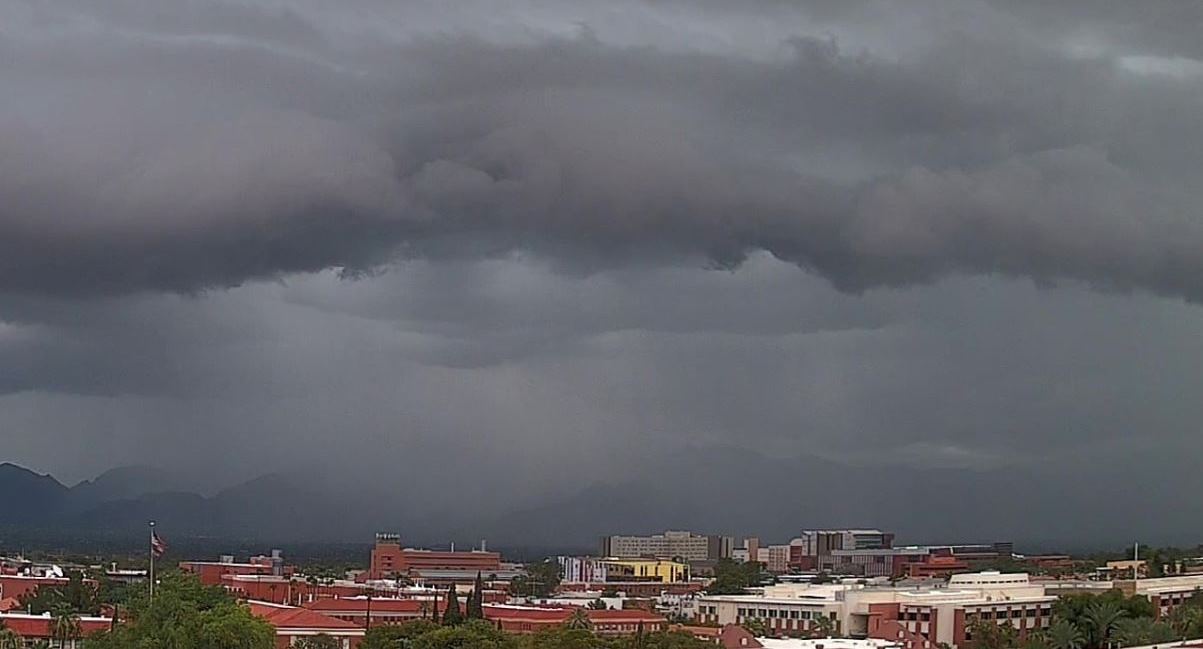
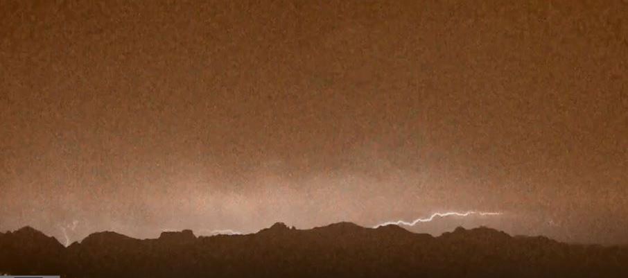
Thunderstorms occurred over much of the Tucson metro area during the late night and again before sunrise. Image above shows lightning over the Catalinas at 4:40 am MST. Photo below is of a morning rainbow taken from house at 5:45 am. Down at bottom is 5:40 am view to the west from downtown, showing a faint, secondary rainbow.


A fairly large MCS developed over southern Arizona by sunrise and moved off toward the Phoenix area. Satellite IR image of system (above at 6:18 am) from NCAR RAL. Below shows composite radar at 6:22 am - also from NCAR RAL.


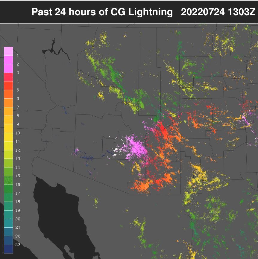
Plot of detected CG flashes (above for 24-hours ending at 1303 UTC - from Atmo and Vaisala) indicates two periods of CG flashes over eastern Pima County - takes a close look to see this. Heavy storm activity indicated over Pinal County around sunrise. Some reports around Casa Grande were approaching 2 inches.

The ALERT plots for 24-hours ending at 6:00 am (below) show that about 80 percent of the sites recorded 0.04" or more rainfall. Note two reports over an inch off toward Redington Pass. Detailed time series plots (from both ALERT and MesoWest) indicate that many sites had rain before midnight and again during the early morning hours. For example: TUS reported 0.18" from 9:00 pm to 10:34 am and then .03" between 4:00 am and 6:00 am. Here at house we had 0.19" which all fell around 4:00 am to 5:30 am.


The morning sounding from TWC/TUS (above - from SPC) is quite moist, with some CAPE and mostly light and variable winds. Sounding was released during the early am rainy period and is likely not representative of the background environment. Would certainly be a good day for a special sounding around noon.

The 12 UTC run of the WRF-RR model forecasts only light showers today for most of the metro area (plot above shows rainfall through midnight tonight). Below is NWS Forecast Office current forecast for airport, indicating high POPs and a Flash Flood Watch in effect through next Tuesday. Quite an active period - will be interesting to watch what actually transpires.


Saturday, July 23, 2022

Fourth Saturday


Another vivid sunrise over the Rincons this morning; the fourth Saturday of July.

There were some thunderstorms scattered around the metro area yesterday afternoon and evening - rainfall reports above from MesoWest for 24-hours ending at 6:30 am MST this morning. TUS and DM both reported thunderstorms with a Trace - here at house we had thunder and a brief, moderate shower that left 0.16" in the gauge. Plot (below) of detected CG flashes (from Atmo and Vaisala) shows that storms were still active this morning from west to north of our area.


Anticyclone (above) at 250 mb has shifted eastward, as forecast by the models, and is now centered somewhere between Tucson and Albuquerque. The morning sounding from TWC/TUS (below) is not very impressive with a deep layer of relatively dry air. If BL mixes out to 600 mb, there is just a sliver of CAPE left. The strong winds at low-levels are also a dilemma, since they may bring in even drier air by afternoon.


The 06 UTC GEFS plumes for QPF above indicate afternoon activity today through Monday. Although I am not very optimistic for storms again here, the 12 UTC WRF-HRRR (below) indicates heavy storms and rain through midnight. Another interesting situation to watch.


Friday, July 22, 2022

Don't Rush!


Heavy clouds with nice coloring over the Catalinas at about 5:30 am MST this morning.

Yesterday I demonstrated that it's not wise to rush a forecast. I ended previous post with thoughts that it might be a big storm day. However, the plot of detected CG flashes (below from Atmo and Vaisala) for 24-hours ending at 1203 UTC this morning (5:03 am MST) shows that thunderstorms completely avoided Pima County. Only report of rainfall across the entire ALERT network was 0.04" near Tubac - the most southern site in the network.


Now for today. Plot above is for the 12 UTC 250 mb level, which shows that the upper-tropospheric anticyclone is centered over the Colorado River, south of Las Vegas. There appears to be a slight bit of difluence over our region. During the next few days the anticyclone will shift eastward, while several upper-tropospheric, inverted troughs move westward along the Borderlands.


The morning sounding from TWC/TUS (above) continues to have considerable CAPE and moisture well-mixed up to above 700 mb. However, substantial lift is still required to trigger low elevation storms. Note also that wind speeds are considerably weaker today through the troposphere. 

Total PW this morning is 1.52", while yesterday morning it was 1.82". However, PW fell during the day yesterday and was only 1.38" in the 00 UTC sounding data. 

The 06 UTC WRF-GFS runs at Atmo are forecasting storms and precipitation this afternoon across eastern Pima County -forecast below shows the model's total precipitation forecast through midnight tonight.


These two panels are from the NWS Forecast office website - above is weekend outlook highlighting potential for severe thunderstorms, and below is the morning forecast for the airport - note the high POPs of 70 % for several periods.


Thursday, July 21, 2022

Quick Post


Thick cloud cover over the metro area at sunrise today.

Only have time for a quick post this morning.


There were storms yesterday evening across southern portions of the metro are; as per plot of detected CG flashes (above - from Atmo and Vaisala) for 24-hours ending at 1:00 am MST this morning. ALERT rainfall for 24-hours ending at 7:00 am this morning (below) has reports only across the southern portion of the network.


Visible satellite image (above for 1416 UTC) shows considerable cloud cover across much of southern Arizona. The morning sounding from TWC/TUS (below from SPC) is very moist, but with somewhat limited CAPE. Winds aloft are very favorable for bringing storms from the White Mountain area southwest toward our region. Areas that get some sunshine later today should see storm development, and it could become a very active day.

Tuesday, July 19, 2022

Little Storm Activity Yesterday


Colorful views this morning around 5:20 am MST: above looking toward the Catalinas and bottom looking toward the Rincons.

Plot of detected CG flashes for 24-hours ending at 8:03 UTC this morning (from Atmo and Vaisala) shows that there was almost no thunderstorm activity in Pima County yesterday - just about exactly as predicted by yesterday's WRF run (see previous post).

Yesterday was very unusual for second half of July with NO ALERT sites reporting rainfall - below for 24-hours ending at 7:00 am this morning. It was yet another dry day here at the house.


The morning 500 mb analysis (above from SPC) shows that the anticyclone is centered about over the White Mountains this morning. The 12 UTC TWC/TUS sounding (below) remains a chopped up mess: limited lower-level moisture; some CAPE above 600 mb; mostly light and variable winds.


However, there was large MCS over the GoC this morning; above IR satellite image from 1151 UTC. Hopefully this system will push higher, low-level moisture northward into southern Arizona today. Meanwhile, this morning's 12 UTC WRF-RR forecast for precipitation through midnight tonight tonight (below) indicates little shower and thunderstorm activity for the entire state today. So it continues to go.


Monday, July 18, 2022

Still Waiting

Views of storms yesterday over the Catalinas (above - at 6:00 pm MST) and Rincons (bottom - at 5:00 pm).

Plot of detected CG flashes (above - from Atmo and Vaisala) is for 24-hours ending at 2:45 am early this morning. Once again thunderstorms mostly avoided eastern Pima County. The activity over rest of state to our north and northwest was quite strong (see severe thunderstorm reports below from SPC). There were 2 reports of severe hail and 10 reports of severe wind gusts - closest event to Tucson was 1 inch hail at San Manuel. Sky Harbor airport in Phoenix reported gusts to 61 mph, while Luke AFB recorded 63 mph. There was a second cluster of severe activity up in the Salt Lake City area.

MesoWest reports of 24-hour rainfall (below, ending at 8:00 am this morning) only show five sites with measurable precipitation. Again, nothing here at house.


The 500 mb anticyclone remains locked over southwest Colorado, with many warm temperatures in -3 to -5 C range - it is a bit cooler aloft over Arizona. The morning sounding (below from TWC/TUS) is considerably more moist and unstable than it has been last week or so. However, the 12 UTC WRF-HRRR forecast indictates dry air from the southeast of here will drop TPW from 1.67' this morning to about 1.25 " by late afternoon. The model's forecast - second below - indicates only isolated showers along the Borderlands.