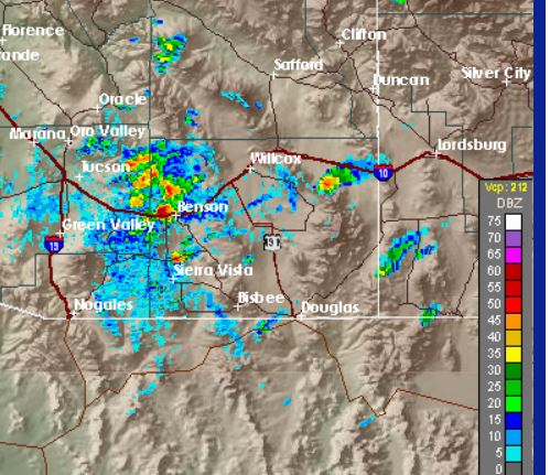
We've been away on a family trip to southern Illinois last couple of days. As we were flying toward Tucson yesterday night about 9:30 pm MST, I could see very impressive lighting flashes in the tops of Cbs far to the east. When I checked radar once we got home, I found that the storms were near Albuquerque and Las Cruces, New Mexico. No rain here while we were away.
Today low-level moisture has pushed westward far enough for thunderstorms to develop over the Rincons - these are fairly impressive visually, but the air quality webcam that should be showing view east toward Rincons is apparently not functioning and two repetitive views of Catalinas are on that site.
Radar above is also impressive and from 2:18 pm. Visible satellite image below is from 2:00 pm. It's possible that these storms could push an outflow into Tucson metro area, although latest MesoWest surface plot seems to indicate most outflow is into the San Pedro valley, east of mountains.
Friday, September 29, 2017
Subscribe to:
Post Comments (Atom)


No comments:
Post a Comment