Thursday, August 01, 2019
Active Afternoon To End July
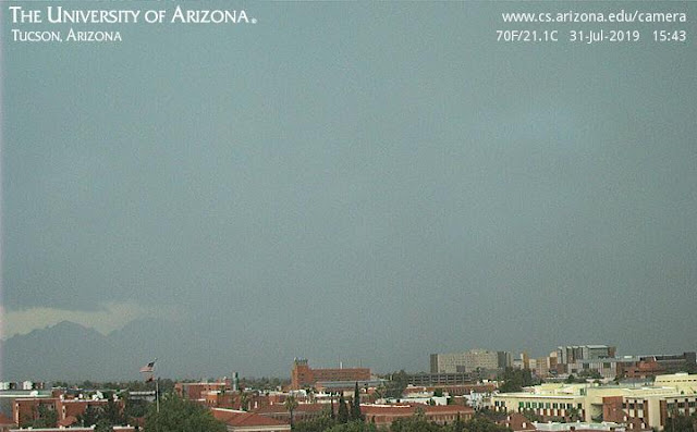
Storm over our part of town yesterday afternoon at a bit before 4:00 pm MST.
We had thunder and 0.37" to end the month. Atmo recorded 0.43"; the airport had 0.37"; and DM AFB recorded 0.91". The ALERT plot below shows 24-hour rainfall ending at 7:00 am this morning. Amounts were generally light except on north end of Catalinas and a part of metro area east of airport. There were 10 reports of more than half an inch (one was was down in south part of network not shown - 0.75" near Amado). Hiding up in Catalinas is a report 0f 3.27", which far exceeded any other amounts.
Skies are mostly clear this morning over most of Arizona - visible image above from 7:00 am. At 500 mb (below from SPC) trough off west coast has nudged the anticyclone center east and south. There appear to be two centers this morning - one over western Oklahoma and other over northeastern Sonora.
Morning sounding for TWC (above from SPC) continues very moist with 1.74" PW and considerable CAPE. Sotherly flow continues through the troposphere, with slightly stronger winds at higher levels.
Forecast TWC sounding below for 5:00 pm (from 06 UTC WRF-GFS forecast) appears favorable for storms. However, the WRF models this morning forecast only isolated showers over eastern Pima County this afternoon. Those forecasts look a bit under-done and I would expect more storm activity this afternoon than is currently forecast. Time will tell.
Subscribe to:
Post Comments (Atom)


No comments:
Post a Comment