Thursday, August 08, 2019
Suppressed
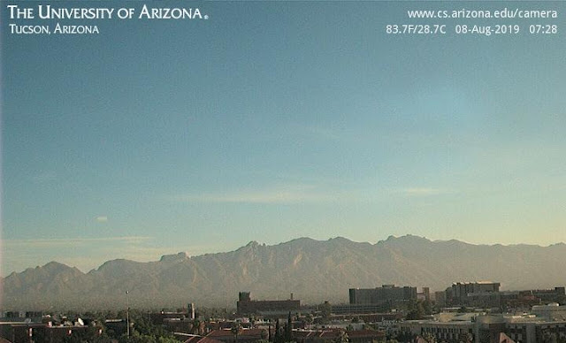
View of Catalinas at 7:28 am MST this morning shows that we had dirty air trapped over Metro area at that time.
View before sunset (bottom, from 7:00 pm yesterday) captured towering Cu over the mountains, with a orphan anvil drifting overhead.
Map of detected CGs (above, for 24-hours ending at 12:30 am this morning - from Atmo and Vaisala) indicates just a bit of thunderstorm activity over southeastern Arizona yesterday, with nothing over the Metro area. Santa Cruz County was apparently storm free, which is unusual for this time of summer.
The morning sounding plot for TWC (below from SPC) is very similar to yesterday, with bit of CAPE and hostile westerly flow through most of troposphere. The early morning WRF forecasts are even more suppressed today in some runs, while 12 UTC WRF-RR tries to get a couple of isolated storms into Metro area. Basically looks like a a similar day to yesterday.
Subscribe to:
Post Comments (Atom)


No comments:
Post a Comment