As per forecasts from past few days, we have showers across the metro area this morning (above). Amounts are currently light, with only a few hundredths to around a tenth of an inch - I haven't ventured out yet to check the gauge here.
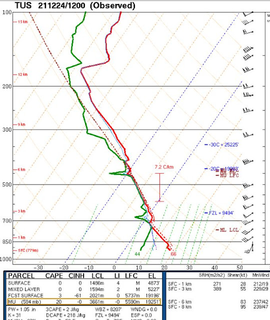
Freezing level is high, as per TWC/TUS morning sounding above, at almost 600 mb - so it's raining on Mt. Lemmon. Photo at bottom shows that way up at Flagstaff it was snowing heavily at 6:40 am MST.
IR satellite image (above) and base scan radar (below - both from around 8:00 am) indicate heavier showers approaching. Regardless, it's definitely a dreary start for the Holiday weekend.


No comments:
Post a Comment