
Skies currently very clear - view south from Kitt peak above at a bit before 7:30 am MST this morning. Model forecasts increasing PW next week, and the current morning forecast from TUS NWS indicates 70 to 80 percent POPS for measurable rain at the airport for every forecast period Tuesday through Friday, July 2nd. I can't remember such high POPs for this long of a period, but certainly will be rooting for storms and some significant rainfall.


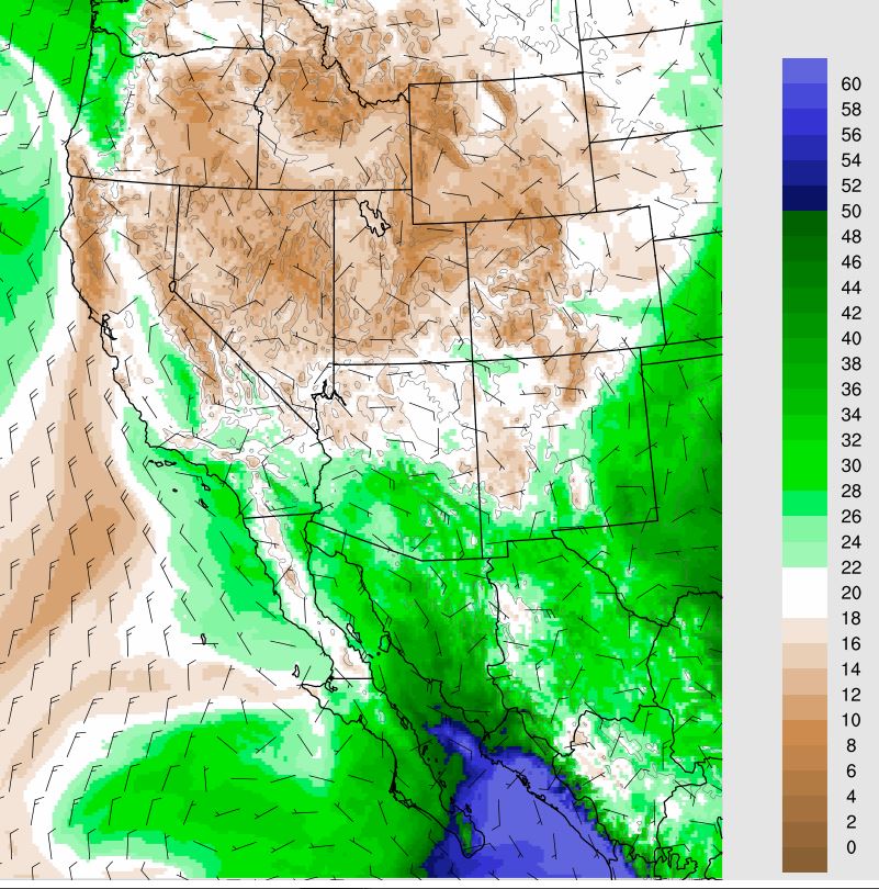
The MIMIC TPW at 13 UTC this morning (above) shows Enrique's swirl of very high values, but with quite dry air over Arizona and the northern half of the GoC. The current model forecasts indicate a quick return of moist air into southern Arizona (below is PW forecast from the 06 UTC WRF-GFS run valid at 1:00 am on the 29th). Note that the increase in southeast Arizona appears to be coming in from the east - given the down-slope trajectories, there could be problems getting decent CAPE over our area. Things will be further complicated by falling pressures at the southern end of the GoC
Below is forecast skew-T for TWC from same WRF run valid at 1:00 am on the 29th. Note the very deep residual boundary layer, with limited CAPE and very high cloud bases. The moisture and CAPE does increase substantially by Tuesday afternoon. Should be an interesting weather week as we head for July.

No comments:
Post a Comment