
Heavy clouds overhead this morning at 6:47 am MST, but with a bit of blue and sunshine over western Catalinas.

Yesterday there were widespread sprinkles, with most sites across metro reporting a Trace - which is what we had here with a very light shower around 7:30 pm.
Plot of detected CG flashes for last 24 hours (below from Atmo and Vaisala) indicates early morning thunderstorm activity to our north and northwest (purples).


The morning sounding plot for TWC/TUS (above) shows continued strong winds aloft and a bit of CAPE below 500 mb. Some wind gusts yesterday afternoon: Marana 41 mph;Tucson 38 mph; DM 41 mph; Nogales 44 mph; and Pioneer Airfield 47 mph.
The 06 UTC GFS forecast for 500 mb, below - valid at 5:00 pm this afternoon - indicates that the trough currently over California, will move to the Arizona/New Mexico border during the day.


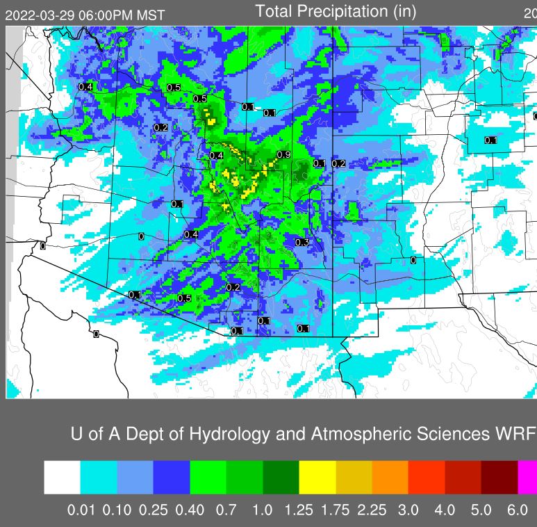
Above is morning rainfall graphic for today from the NWS Forecast office - POPs for airport are 100 % with amounts of a quarter to half an inch expected. The 06 UTC WRF-GFS forecast for precipitation (below, valid through 6:00 pm this evening) indicates not quite as much at the airport, but with higher amounts over much of eastern Pima County.
No comments:
Post a Comment