Nice view looking toward the Rincons at 5:30 am MST this morning.
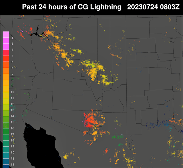
Considerable thunderstorm activity over most of eastern Pima and Santa Cruz Coutnies yesterday afternoon and evening - as per plot of detected CG flashes for 24 hours ending at 0803Z this early morning. There was rumbling thunder here for a long period in the evening.
Rain was scattered through much of the ALERT netwrok - plots here for 24 hours ending at 7:00 am this morning. Note that several sites had more than half an inch.
Here at house: first - I neglected to check the gauge yesterday and when I did I found that there had been 0.02" during the night Saturday. Light sprinkle showers around dark yesterday left only 0.01" in the gauge this morning.
The 500 mb analysis this morning (above from SPC) shows an impressive anticyclone centered over southwestern Colorado. However, warmer and drier air is upstream and threatens to impact our area.
The morning sounding (below) has considerable CAPE, but still has large T/Td spreads below 700 mb. Given my problems with the soundings last few days, I'm not sure what to make of today's situation. Several pluses and minuses are at play. The WRF runs this morning tend to keep storms to our south and west later today. The NWS morning forecast keeps airport POPs at 30 to 40 percent through Wednesday. I am just going to have to be an observer this afternoon, while hoping for the best.


No comments:
Post a Comment