Sunday, June 19, 2022

Showers Parts Of Metro


Clouds over the Catalinas this Father's Day morning at a bit after 7:00 pm MST. View at bottom is from yesterday afternoon, when showers and storms were developing over northern parts of metro area. Plot of detected CG flashes yesterday (below from Atmo and Vaisala through 0133 am CST last night) indicates an active storm day over much of eastern Arizona and New Mexico..

Rain amounts (second below, from ALERT ending at 7:00 am this morning) were generally light, except for several sites on and near the Catalinas that reported over half an inch.

Here at house there was rain in the gauge - finally, but amount was only 0.02".


This mornings 500 mb analysis (above) shows the West coast trough inching closer, with the large, central US anticyclone centered over Iowa/Missouri.


The morning sounding from TWC/TUS (above) continues to indicate at least a sliver of CAPE, with southwesterly winds aloft. There will be a battle between dry air to our west and more moist air to the east today. This morning's 12 UTC WRF-RR forecast from Atmo indicates that showers will stay mostly to the east of the metro area this afternoon and tonight (below).


Friday, June 17, 2022

Showers Possible


Middle clouds over the metro area at about 7:30 am MST this morning.

The current 500 mb analysis (below) shows Arizona in the zone between the large anticyclone over US and a strong trough over the west coast.


This morning's TWC/TUS sounding plot (above) shows low levels remaining dry and a lack of CAPE. Thus, if storms are to develop this afternoon and evening, there needs to be a considerable increase in low-level moisture. The forecast sounding (below - from the 06 UTC run of the WRF-GFS at Atmo) indicates a significant increase (surface dewpoint increasing from around 32 F to the middle 50s F), along with development of some CAPE.


Plumes from the 06 UTC GEFS forecasts (above PW at airport and below QPF at airport) show a strong increase in PW during the day today, with showers through much of tonight and Saturday.


Forecast radar echoes above from the WRF run cover most of the metro area at 7:00 pm this evening.

Below is the morning forecast from the NWS Forecast Office - putting the most significant POPs for the airport during the day Saturday, as per the various model forecasts shown above.  Hoping to see the first rain in the gauge after nearly three, totally dry months.

Thursday, June 16, 2022

Little Change

Clear skies just before sunrise this morning at about 5:15 am MST.

The 500 mb pattern at 12 UTC this morning (below) is quite chaotic because of weak height gradients. There is basically a large ridge which extends from the Carolinas westward to Arizona. There appear to be anticyclone circulation centers over Arkansas and the Carolinas.


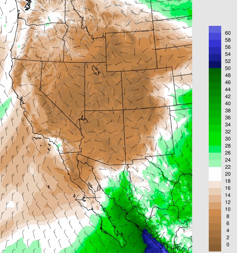
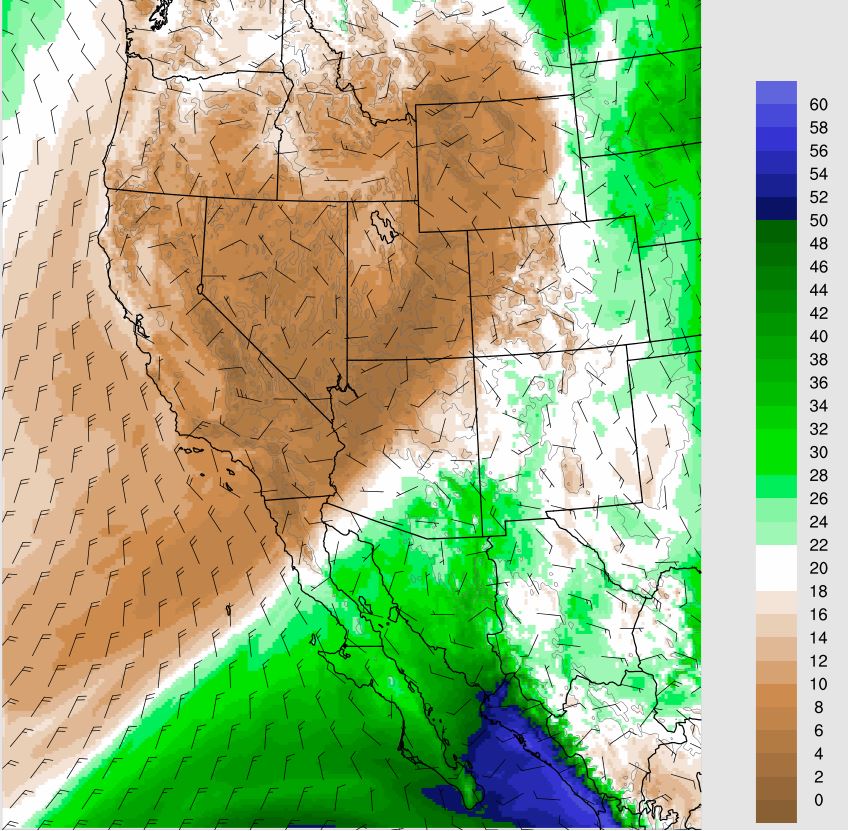
As Hurricane Blas moves westward south of 20 N, low-level moisture pushes slowly northward into southeastern Arizona. The PW plots here are from the 06 UTC WRF-GFS valid at 06 UTC this morning (above) and at 06 UTC on the 19th (below).


The increased moisture leads to thunderstorm activity by the weekend, particularly on Saturday. The two forecasts shown here are for total precipitation from now through 11:00 PM Sunday night. The forecasts are similar, but with the GFS (above) indicating a bit more rainfall in eastern Pima County than does the WRF (below). 

Wednesday, June 15, 2022

Showers By Weekend?

Skies this morning (above), while not pristine, are considerably cleaner than they were yesterday afternoon (bottom).


While PW is VERY low this morning, the 06 UTC GEFS forecasts a very rapid increase beginning tonight - see forecast plumes above. The models plumes for precipitation indicate precipitation at the airport,  mainly on Saturday - note the very large range of amounts forecast by the ensemble members.

In contrast, the 06 UTC WRF-GFS forecast above (valid through noon on Sunday) keeps the band of rainfall east of us, with no rain at the airport. So, considerable variance among the forecasts. This morning's forecast for the airport, from the NWS, is shown below.


Further south, Tropical Storm Blas is off the southwestern coast of Mexico. The NHC forecasts Blas to become a hurricane this morning, and to move away from land toward the west-northwest.

Saturday, June 11, 2022

Hot And Isolated Storms


Copper skies last evening at 7:15 pm MST.


Storms were more widespread yesterday than I expected, given the marginal morning sounding and model forecasts - of course, storms mostly avoided the metro area. Plot of detected CG flashes (above - for 24 hours ending at 2:00 am early this morning) indicates considerable thunderstorm activity from our north to east to southwest. The Atmo movie for yesterday shows some frequent lightning flashes northeast of the Catalinas - worth a look.


This morning's 500 mb analysis (above) shows that the 500 mb anticyclone has shifted to eastern New Mexico, putting our area in weak, southerly flow at that level. The 12 UTC sounding plot for TWC/TUS (below) shows some slosh-around increase of moisture in low-levels, variable winds, and a sliver of CAPE. The 06 UTC WRF-GFS forecasts isolated storms this afternoon over the far southeast corner of the state - but, given yesterday's activity, I'd be hesitant to rule out storms over the nearby mountains.


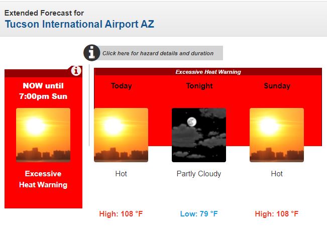
Current morning forecast for the airport (above) - clicking around the metro area, I see that many spots have a forecast high today of 110 F.

The five day outlook from NHC (below) indicates that tropical storm development off southwestern coast of Mexico is likely during next few days.

Friday, June 10, 2022

Storms But Little Rain


Storm over Catalinas (above and bottom) a bit before 6:00 pm yesterday.


Plot of detected CG flashes (above, from Atmo and Vaisala) for 24-hours ending at 12 UTC today, shows that thunderstorms stayed east to south to southwest of metro area yesterday. There was little rain in Pima County, with two reports of less than a tenth of an inch in the Catalinas and Rincons - slightly higher amounts down in Cochise County.


The 500 mb analysis this morning (above) shows a 5920 m anticyclone centered over the White Mountains - a fairly dismal pattern. The morning sounding from TWC (below) shows dry low levels and a lack of CAPE.


The 12 UTC forecast from the WRF-HRRR model run indicates only some isolated thunderstorms along the border for today - forecast below is valid at 5:00 pm this afternoon.


Wednesday, June 08, 2022

Slight Chance For Showers

Cirrus clouds this morning over the Catalinas at 8:00 am MST.


At 500 mb this morning (above) there is a weak, inverted trough over Baja and an anticyclone over southwestern New Mexico. The inverted trough is forecast to become more pronounced and help push low-level moisture northward toward southern Arizona. The 14 UTC analysis of TPW (below) indicates current values of an inch and a half, or a bit more, over the southern half of the GoC.


By 18 UTC tomorrow the 06 UTC GFS forecasts TPW to reach over an inch across parts of southern Arizona (below).


The 09 UTC run of the WRF-RR at Atmo indicates showers and storms just south and east of the metro area at 5:30 pm (above) tomorrow. The showers produce fairly strong outflows as they near the metro area. The same WRF forecast indicates wind gusts of 34 kts near the airport at 3:30 pm (below). Will be interesting to watch what actually transpires tomorrow!

Monday, June 06, 2022

Hot This Week


Have been away for a few days in northern Arizona, where it was a bit cooler than down here in the desert.


The 06 UTC GEFS plumes for temperature above reach to 105 F or a bit over by the weekend.


The NWS Tucson Forecast Office has issued an "Excessive Heat Watch" for Thursday through Sunday, as per above.

The current Tucson forecast below indicates highs on Thursday and Friday of 107 F, and highs of 109F for Saturday and Sunday. The main question for the coming weekend will be: Will the high temperature reach or exceed 110 F?

Wednesday, June 01, 2022

June 1st

Clear skies this morning, but with a bit of dust and haze in the morning boundary layer.

Today is the first day of meteorological summer.


This morning's five day outlook from NHC (above) indicates that the remnants of Pacific Hurricane Agatha are expected to re-develop into a tropical storm and move toward Florida.


The summer outlook from NWS Climate Prediction Center (above and below) indicates hot temperatures across almost all of the country, as well as below normal precipitation across much of the West and the Plains. Southeast Arizona is an exception, with the outlook anticipating above normal precipitation during the monsoon season. This would be a welcome change here, since there's been no rainfall since March 23rd.