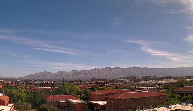
Cirrus clouds this morning over the Catalinas at 8:00 am MST.
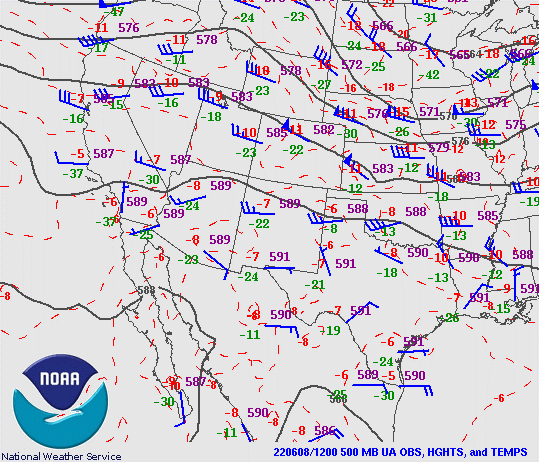
At 500 mb this morning (above) there is a weak, inverted trough over Baja and an anticyclone over southwestern New Mexico. The inverted trough is forecast to become more pronounced and help push low-level moisture northward toward southern Arizona. The 14 UTC analysis of TPW (below) indicates current values of an inch and a half, or a bit more, over the southern half of the GoC.
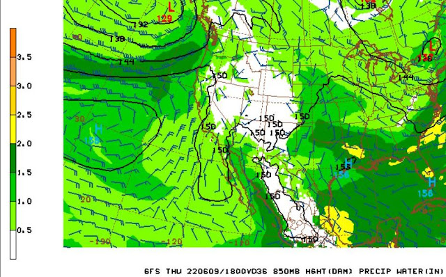
By 18 UTC tomorrow the 06 UTC GFS forecasts TPW to reach over an inch across parts of southern Arizona (below).
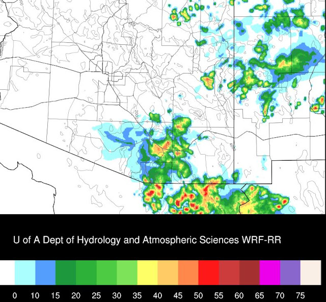
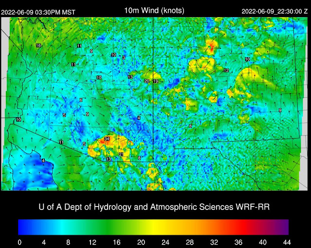
The 09 UTC run of the WRF-RR at Atmo indicates showers and storms just south and east of the metro area at 5:30 pm (above) tomorrow. The showers produce fairly strong outflows as they near the metro area. The same WRF forecast indicates wind gusts of 34 kts near the airport at 3:30 pm (below). Will be interesting to watch what actually transpires tomorrow!

No comments:
Post a Comment