Copper skies last evening at 7:15 pm MST.
Storms were more widespread yesterday than I expected, given the marginal morning sounding and model forecasts - of course, storms mostly avoided the metro area. Plot of detected CG flashes (above - for 24 hours ending at 2:00 am early this morning) indicates considerable thunderstorm activity from our north to east to southwest. The Atmo movie for yesterday shows some frequent lightning flashes northeast of the Catalinas - worth a look.
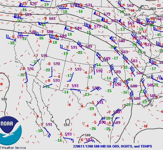
This morning's 500 mb analysis (above) shows that the 500 mb anticyclone has shifted to eastern New Mexico, putting our area in weak, southerly flow at that level. The 12 UTC sounding plot for TWC/TUS (below) shows some slosh-around increase of moisture in low-levels, variable winds, and a sliver of CAPE. The 06 UTC WRF-GFS forecasts isolated storms this afternoon over the far southeast corner of the state - but, given yesterday's activity, I'd be hesitant to rule out storms over the nearby mountains.
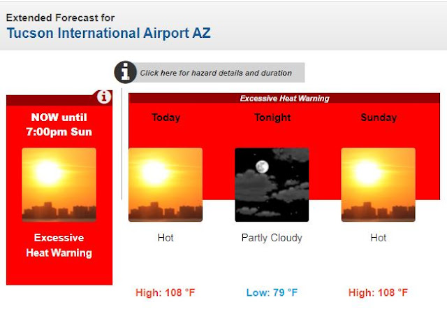
Current morning forecast for the airport (above) - clicking around the metro area, I see that many spots have a forecast high today of 110 F.
The five day outlook from NHC (below) indicates that tropical storm development off southwestern coast of Mexico is likely during next few days.


No comments:
Post a Comment