Yesterday was quite suppressed - much more so than was Sunday. Several areas of storms to the east and south did produce outflows that sloshed around southeastern Arizona late. Only 4 of 93 stations in the ALERT network had rainfall during past 24-hours, and amounts were very light (all less than 0.10").

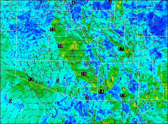
This morning (Tuesday, 10 July 2012) there has been a dramatic increase in regional cloud cover (see 7:15 am MST visible satellite image above). A large MCS moved from northern Sonora westward along and south of the border during the evening and night - this has spread middle and high cloud debris westward across northern Baja and into southern California. To the east, clouds cover almost all of New Mexico and Northern Mexico - cloudiness has increased due to northeasterly low-level winds on the cool, moist side of a cold front that pushed south along the Front Ranges. This is the front that is bringing relief from the heat wave to the central and eastern US. Precipitable water remains around 30 to 35 mm across southeast Arizona, but values are a bit better to the east. The early, WRF-GFS forecast actually indicates a slight decrease in PW this afternoon from Tucson off toward Phoenix. The morning soundings indicate little CAPE for the low elevations of south central Arizona. The WRF-GFS forecast of CAPE for 4 pm MST (below) indicates almost no CAPE present across all of Pima County. If we are to get storms from the mountains to the northeast to propagate into the deserts, we need an increase in CAPE - either from cooling in middle levels or an increase in low-level moisture. The model, however, does not forecast such changes today.

Atmo's version of WRF-GFS does forecast a strong outflow to move across the Tucson area around 6 pm MST this afternoon (10-m wind forecast above). This would be somewhat similar to yesterday, but stronger due to better coverage of storms from northeast to east. The forecast of total precipitation through midnight tonight is shown below - the model again forecasts storms to weaken as they try to come west-southwest across the Rincons and Catalinas. So, the the thing to watch for today would be an increase in low-level moisture (i.e., a PW trend different than is forecast) that would increase chances for low-elevation storms.

Finally, although once Hurricane Daniel has weakened dramatically over the Pacific, Emilia has strengthened rapidly during the past 24-hours and is now estimated to be a Category 4 hurricane by the NHC (Emilia is south of Baja in the IR image below).

No comments:
Post a Comment