The surface obs overnight indicated that a bit of very shallow, low-level moisture may have slipped across the border - but no substantial outflows made it into southeastern Arizona. The plot below (from Vaisala and Atmo) shows CG flashes detected for the 12-hours ending at 11 pm MST last night. Thunderstorms stayed south of the border but had inched northward compared to recent days - a good sign.
The morning TWC upper-air data are quite dismal again - skewT plot of 12 UTC data above from SPC. The PW continues right around an inch, a miserable value for early Augusr. Temperatures aloft are very warm and middle of troposphere has light, variable winds. I guess that it can only get better.
The experimental, blended PW product at CIRA is updating again and the analysis for 12 UTC is shown below. More moist air is seeping north on this side of the border out to our west, and values greater than 2 inches extend almost to the north end of the GoC - another nice MCS over northern Sonora could have a big impact this evening and push some of that moisture further into Arizona.
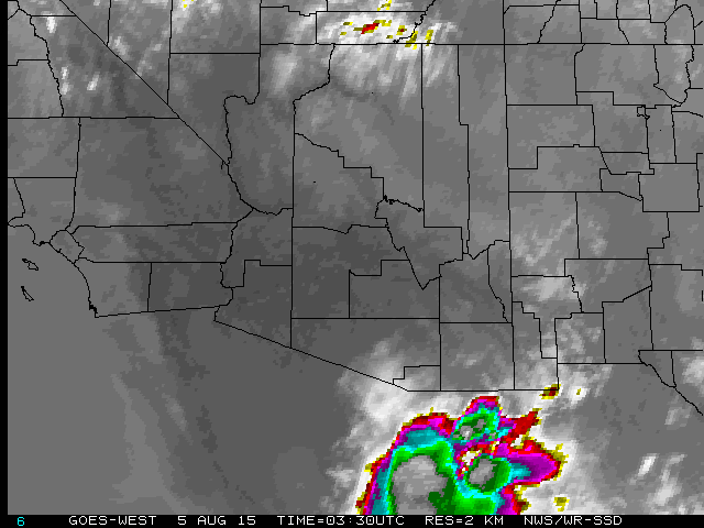
An MCS with very cold cloud-top temperatures has been moving north over Sonora for the past few hours. The big question for tonight is whether or not the outflows associated with this convective system will move north into the Tucson area by sunrise. The image above is the IR satellite image from 0330 UTC this evening, and below is the plot of detected CG flashes (from Vaisala and Atmo) through 0300 UTC.


No comments:
Post a Comment