Murky skies this morning in the San Antonio area of Texas (above) after a large dust storm in New Mexico and west Texas yesterday afternoon and evening. The surface map from 0158 UTC (6:58 pm MST) yesterday (below) shows the strong winds that picked up the dust - note the reported gusts of 35 to 54 kt from the west. The associated cloud of dust is shown in the satellite image second below from 2345 UTC.
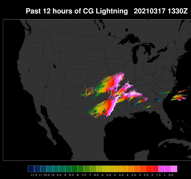
Thunderstorms developed ahead of the strong cold front - plot above shows detected CG flashes for 12-hours ending at 1330 UTC this morning - note the dry intrusion and lack of storms from southwest Texas into Oklahoma. There were 81 scattered severe thunderstorms reported from Alabama westward.
The morning severe storm outlook from SPC (above) includes an unusual "High Risk" area in the Southeast. Forecasts from the 06 UTC GFS (500 and 850 mb below) show the strong 500 mb closed low swinging into the Southeast, as a distinct plume of high moisture at 850 mb intrudes northward into the region.
We'll remain fair and dry with temperatures in the 70s and into the 80s for the rest of the week - enjoy our fine weather.


No comments:
Post a Comment