Heavy, threatening cloud cover this morning over Tucson. At bottom, the webcam at Prescott airport caught a small plane taking off.
At 500 mb this morning (12z analysis above from NCAR RAP) a weak short wave is located from eastern Nevada south to the northern end of the GoC. This feature has a fair amount of clouds and moisture with it and will move across Arizona rapidly today. The morning TWC sounding (below) shows that the moisture is above 600 mb and that low-levels are quite dry.
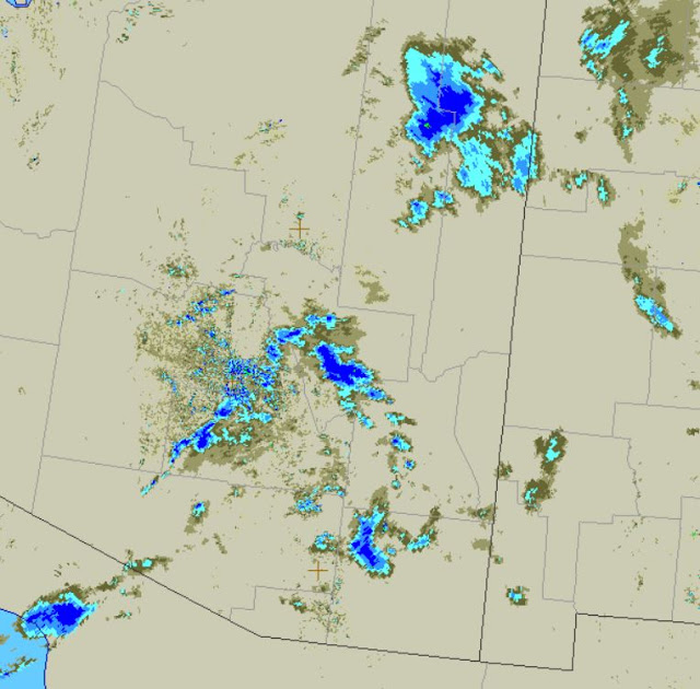
IR satellite image above shows the clouds over all but northwestern Arizona at 1421 UTC. Regional radar (below, from base scans) shows some weak echos over southeastern Arizona - so there may be some light sprinkles around the area.
For the rest of the week through next weekend, the 06 UTC GEFS plumes (above) indicate high chances for showers with measurable precipitation on the 11th and 12th. The forecast QPF amounts however range from zero to over 0.70" - so much uncertainty regarding possible rain on the ground. If there is measurable rain this week, it will be the first since January 29th.
GEFS forecast for temperature (below) indicates much cooler for mid-week - especially Thursday and Friday - but then a rapid warm up for next weekend.
Second below shows 06 UTC WRF-GFS forecast for winds tomorrow at 2:00 pm, indicating a breezy to windy day for almost the entire state, with strongest gusts likely along the Rim Country.


No comments:
Post a Comment