
Yesterday afternoon (May 31st - the IR satellite image above is from 0015 UTC on 1 June) there were several large MCSs over west Texas and northern Mexico. These produced severe thunderstorms and locally heavy rains - Art Douglas says he saw a report this morning of 3.90" at the Presidio, Texas, International Bridge (west of Big Bend National Park).
------------------------------------------------------------------

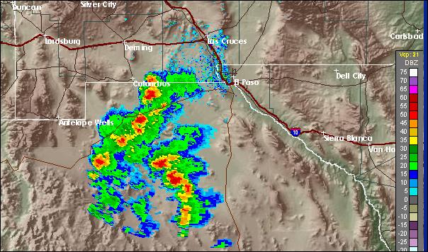
This afternoon there are storms along and east of the Continental Divide in northern Mexico and New Mexico. The visible satellite image at top is from 2145 UTC, and the El Paso radar image below is from nearly the same time. Closest thunderstorm activity in quite some time - holds out a glimmer of hope, but the real summer thunderstorm season for southern Arizona remains weeks away.
No comments:
Post a Comment