Clear, dry skies a bit before sunrise this morning - above.
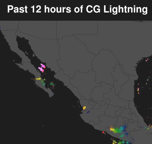
Tropical storm Olaf (above) is over the south end of Baja this morning, moving toward the northwest. There were thunderstorms and CG flashes to the north of Olaf as per detected CG plot (below, from Atmo and Vaisala) for 12 hours ending at 8:00 am MST this morning.
The current NHC forecast for Olaf turns the storm abruptly west and then southwest (above). The track of Olaf should increase the flow of moist air up the GoC. Since it is already quite moist all the way into the lower Colorado Basin (below is 12 UTC analysis of PW from the 12 UTC WRF-RR run at Atmo), there won't be a "surge" per se, which requires very dry air ahead of a low-level moisture push. The same model run keeps most of of Arizona dominated by very dry air (second below) through 10 am next Monday morning.
The 500 mb anticyclone is centered near Albuquerque this morning - this could be a favorable position for storms over southeastern Arizona, if there were higher low-level moisture and CAPE present - see the dismal morning sounding below for TUS/TWC. Unless there is a surprise push of deeper moisture related to Olaf, we are looking at a continuing, extended period of hot and dry weather.


No comments:
Post a Comment