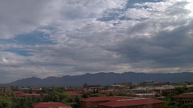
Middle cloudiness over the Catalinas and metro area this morning, a bit before 8:00 am MST.
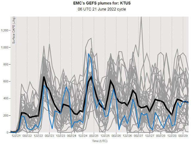
The morning sounding from TWC/TUS (above) shows increased middle-level moisture, but the layer below 650 mb remains quite dry, with PW a bit below an inch. The sounding has only a hint of CAPE, and low level moisture will have to increase considerably to support widespread thunderstorm activity this afternoon. The 06 UTC GEFS plumes for CAPE (below) indicate only slight CAPE this afternoon and tonight.
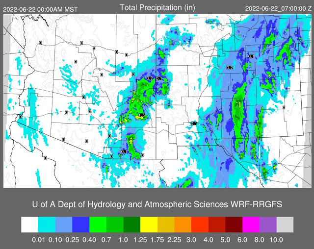
Forecasts here from the 06 UTC run of the WRF-GFS (above) and from the 12 UTC WRF-RR (below). The WRF-RR forecasts considerably lighter amounts across eastern Arizona than does the earlier WRF-GFS. Based on the morning sounding, I would tend toward the WRF-RR and expect light showers across eastern Pima County, with limited thunderstorm activity this afternoon.
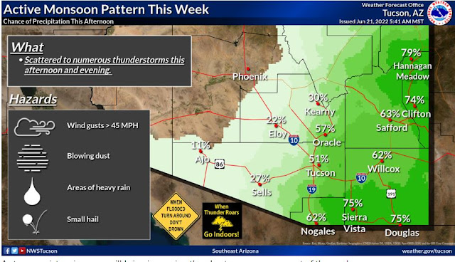
Current NWS morning weather story is second below, and is more similar to the WRF-GFS forecast for eastern Arizona. It's a tough forecast today and the weather outcome will depend on how much CAPE actually develops - really hurts not to have a morning Guaymas sounding!


No comments:
Post a Comment