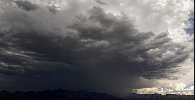
Heavy storm over the Catalinas yesterday afternoon about 2:30 pm MST.
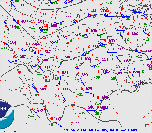
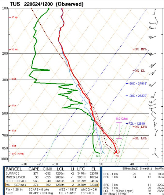
The 500 mb analysis this morning (above - ignore the bad analysis of a closed low to our east) indicates a weak trough from Four Corners region south to end of Baja. The TWC/TUS morning sounding (below) is quite a mess. There are signals of the influence of mesoscale downdrafts, little CAPE, some middle level moisture, and a chopped-up wind profile below 400 mb. I'm hard pressed to find anything good to say, but can hope that there might be some improvements during the day.
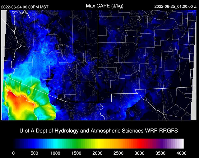
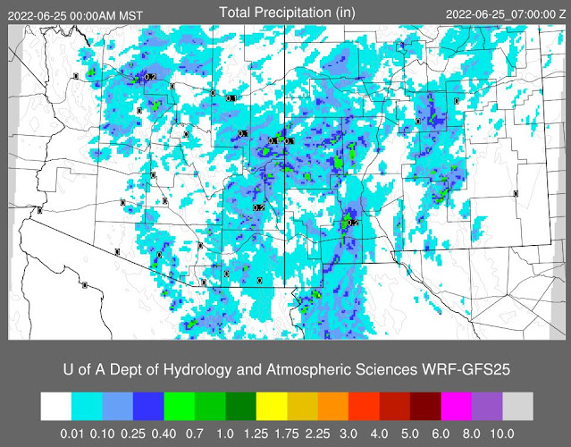
Two graphics here from Atmo's WRF runs to look ahead for this afternoon. Forecast above is from the 12 UTC WRF-RR and shows CAPE at 6:00 pm being very small in our area. Forecast below is for rainfall through midnight tonight (from the 06 UTC WRF-GFS - 12 UTC WRF-RR is very similar). So, the models predict another day with widely scattered storms, but not much in the way of significant rainfall.

No comments:
Post a Comment