Towering cumulus over parts of the Catalinas at 5:50 am MST this morning. The high temperatue at the airport yesterday reached 108 F, breaking the previous record of 107 F set in 1985.
Tonight will be a blue super moon - the next one will not occur until 2037 (so quite a rare event tonight).
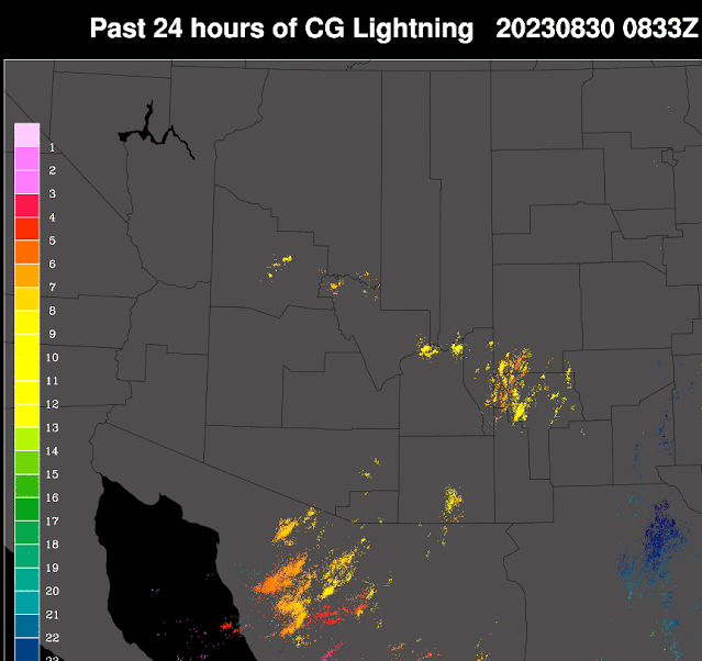
Plot of detected CG flashes (from Atmo and Vaisala) above is for 24 hours ending at 0833 UTC this morning. Isolated storms did occur yesterday in southeast Arizona and along the Rim country.
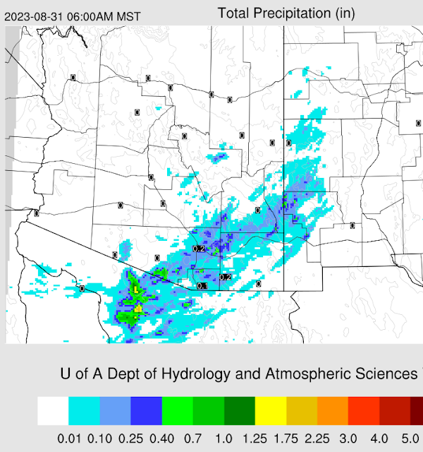
There were only two reports of rainfall across the entire ALERT network yesterday - .04 and .08" at two sites on Mt. Lemmon.
The 500 mb analysis this morning (above from SPC) shows an elongated anticyclone stretching from southern California to northern Kansa, with no distinct circulation centers. Hurricane Idalia made landfall in northern Florida this morning.
The morning sounding for TWC/TUS (below - also from SPC) continues un-impressive with a deep, dry BL and little CAPE, There is a layer of east-northeast winds of about 30 kt above 500 mb - so stronger steering flow compared to last several days.
Model forecasts vary widely this morning. The plumes from the 06 UTC GEFS (above) indicates a very active period Friday and Saturday, The 06 UTC WRF-GFS (below for period ending 6:00 am tomorrow morning) indicates an active day with widespread rainfall across the metro area. The current NWS forecast (bottom) indicates moderate to high POPs for the airport beginning tonight and extending through Saturday night.


No comments:
Post a Comment