
View looking toward the Rincons about 6:15 am MST this morning.

Plot of detected CG flashes (above from Atmo and Vaisala) for 24 hours ending at 0803 UTC early this morning. I had expected a mostly suppressed day, but instead we had more showers.

ALERT observations for 24 hours ending at 7:00 am MST this morning. Rainfall was scattered across most of the network. We had 0.05" here during an afternoon shower. Atmo recorded only 0.01", and both the airport and DM have had no observations since about 2:00 pm yesterday afternoon.

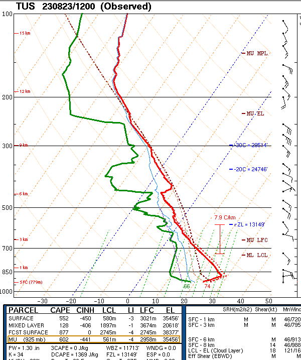
The remnants of TS Harold are near the Big Bend this morning, and the associated inverted trough is forecast to move slowly across Arizona tonight and tomorrow. The sounding at TWC/TUS (above) again looks unfavorable for thunderstorms. However, the sounding at El Paso (below) is very moist through the entire troposphere - quite a differnce between here and there.


Forecast models this morning keep the swath of precipitation occurring with the Harold remnants well northeast of here (above forecast through noon tomorrow from the 12 UTC WRF-RR). The current NWS forecast is shown below, with POPs up to 50 percent for the airport this evening. I'll wait and watch what evolves.

No comments:
Post a Comment