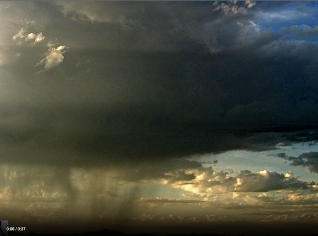
Showers over Redington Pass at 6:25 am MST this morning.
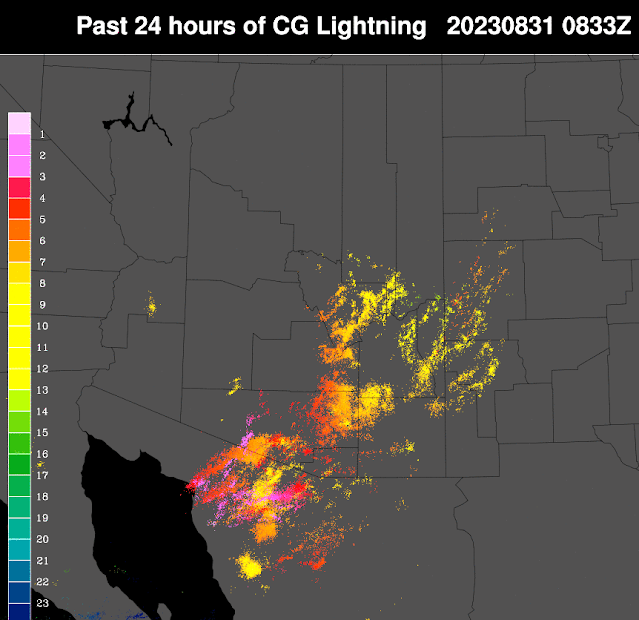
Plot of detected CG flashes (below from Atmo and Vaisala) through 0833 UTC indicates widespread thunderstorm activity yesterday over most of the metro area.
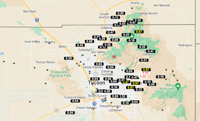
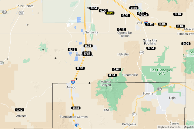
ALERT data for 24 hours ending 7:00 am this morning (above and below) shows rainfall over much of the network, with a number of sites recording over half an inch of rain.
Here at house we had thunder, wind gusts of 40 to 50 mph during the late afternoon, followed by showers after dark that left 0.13" in the gauge. The airport recorded gusts to 45 mph with 0.06"; DM reported gusts to 49 mph and 0.09"; Atmo had 0.06" along with gusts to 36 mph. There was one severe wind report in the east metro where gusts to 59 mph occurred.
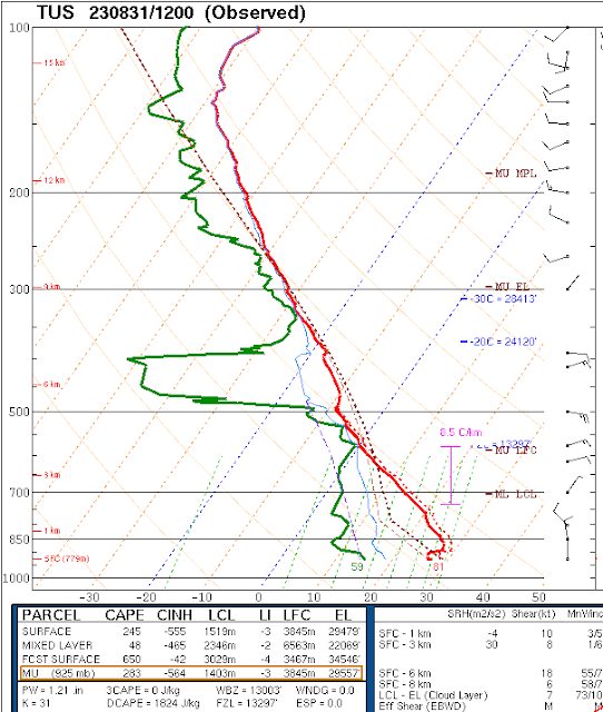
The morning sounding continues similar to last few days with a deep and relatively dry old BL and light winds aloft. Precipitable water was 1.21 inches, with just a sliver of CAPE.
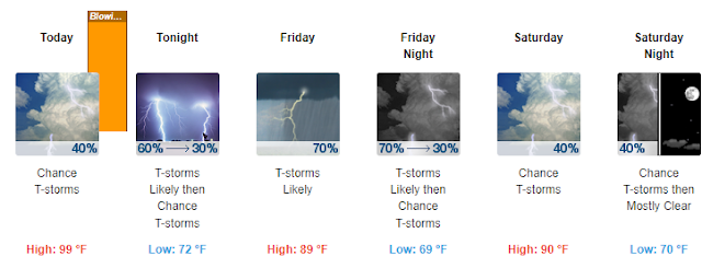
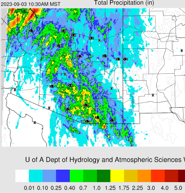
The morning forecast from the NWS (above) notes a blowing dust advisory for today, along with high POPs through Saturday. Forecast below (from the 06 UTC WRF-GFS) shows rainfall through 10:30 am Sunday morning. The WRF forecast from yesterday morning verified quite well - see previous post.
No comments:
Post a Comment