
Another golden, pre-sunrise view to the northeast this morning. Yesterday's high temperature of 109 F set a new record high, breaking the 107 F recorded in 1998 and again in 2020.

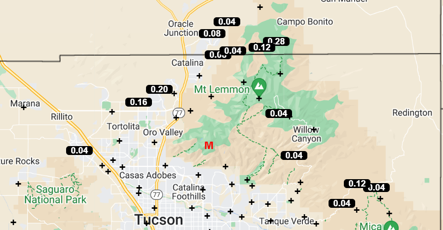
Plot of detected CG flashes (above - from Atmo and Vaisala) for 24 hours ending at 0903 UTC this morning shows just some isolated flashes in the metro area yesterday. ALERT plot (below) for 24 hours ending at 8:00 am MST this morning rainfall shows light amounts on and near the mountains. In the south part of network Florida Canyon reported 0.12" and Arivaca had 0.04". Nothing here at the house.

The morning sounding for TWC/TUS (above) continues unimpressive, with light winds aloft and just a sliver of CAPE.

The 06 UTC WRF-GFS forecast (above) keeps Arizona basically rain-free through noon tomorrow. Morning NWS forecast POPs through Thursday are shown below. The nasty heat continues today and tomorrow.

No comments:
Post a Comment