
View looking toward Redington Pass this morning at about 5:50 am MST.
Plot of detected CG flashes (below, from Atmo and Vaisala), for 24 hours ending at 0733 UTC this morning, shows heaviest concentration of flashes extending from Santa Cruz County to Pinal County, crossing the metro area.

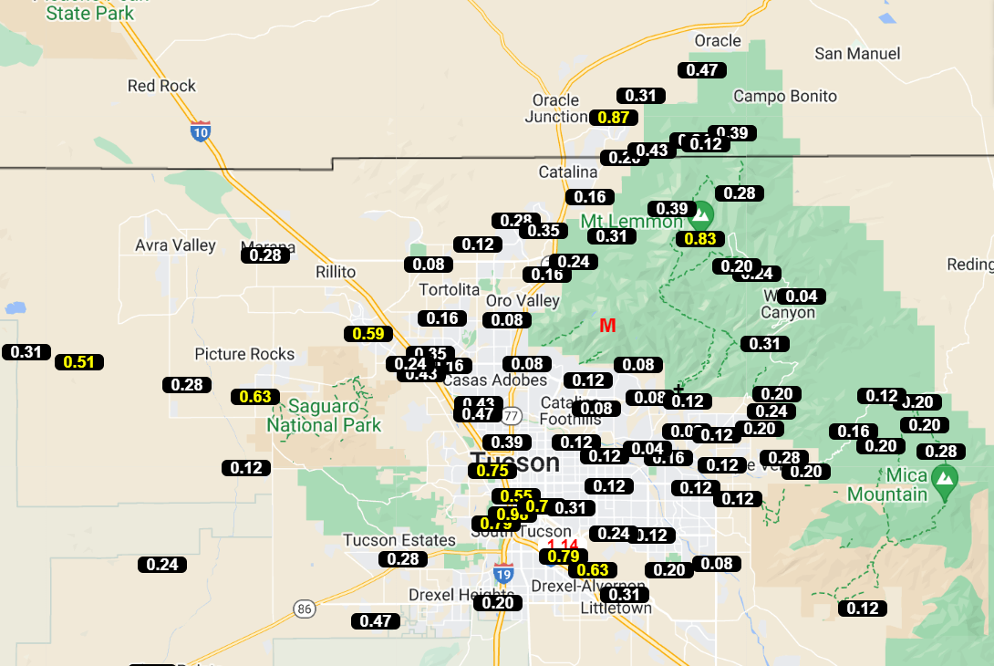
Rainfall was obeserved at every ALERT site (except Arivaca) during the 24 hours ending at 7:00 am this morning, with quite a few sites reporting over half an inch. The airport had 0.71" with gusts to 48 mph; Atmo reported 0.71" with gusts to 42 mph; DM had 0.42" with gusts to 43 mph; and we had only 0.18" (not sure about wind gusts here).


At 500 mb this morning (above from SPC) there is a massive 600 dm+ anticyclone centered over northern Missouri. Tropical Storm Harold is coming ashore near Corpus Christi, Texas, currently, and its remanants will head toward the Big Bend and southern New Mexico. It's not clear to me whether the wave with Harold will make to southern Arizona, although models are currently forecast this to occur.

Tucson sounding this morning (above) was truncated at 200 mb. The sounding shows a classic onion shape, following yesterday's rains. There is little, if any, CAPE for a deeply mixed BL. Following yesterday's rains, I would expect most of the area to be suppressed today. Which is what the 12 UTC run of the WRF-RR model at Atmo indicates (below). However, the NWS is keeping 30 to 40 percrnt POPs for the airport through Thursday (second below).


No comments:
Post a Comment