
Heavy storm over the eastern Catalinas yesterday afternoon at 4:00 pm MST. The plot of detected CG flashes for 24 hours ending at 0703z this morning (below - from Atmo and Vaisala) shows that this was the main storm that impacted eastern Pima County.


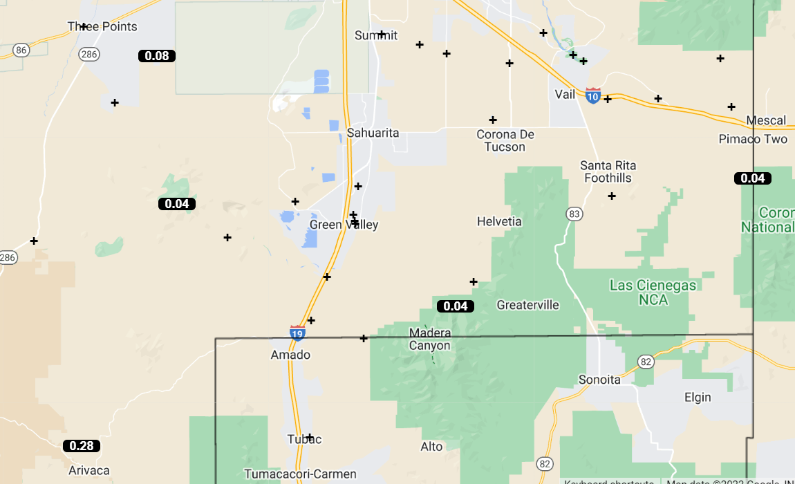
Plots of rainfall across the ALERT network (above and below) are for 24 hours ending at 7:00 am this morning. Even though NWS POPs were at 70 percent for yesterday afternoon, the low elevations remained mostly rain-free. Yesterday's WRF, however, was quite accurate. Nothing here at house - it's getting pretty dry, since there's only been 0.02" here during August.

Graphic above (from NWS webpage) shows temps and POPs for today. It's a bit hard to read, but all the POPs range 40 to 60 percent.


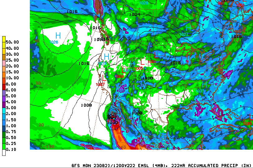
Although the Atlantic is not active, the eastern Pacific has several disturbances - above is morning outlook from the NHC. The GFS forecast (below, valid through 12 UTC on August 21st) shows a TS or hurricane tracking northward along the west side of Baja. Model keeps Tucson area just east of the heaviest precipitation - but it will be interesting to watch how things evolve over the eastern Pacific next week.
No comments:
Post a Comment