View looking toward the Catalinas at 5:45 am MST this morning, showing heavy clouds with some color.
Plot of detected CG flashes (from Atmo and Vaisala) for 24 hours through 0733 UTC this early morning shows widespread storms across Arizona yesterday. There were 10 reports of severe winds yesterday evening, and these reached from Picture Rocks north of Tucson out to Bullhead City.
ALERT data through 7:00 am this morning show widespread rain, except across much of the metro area. Here at house we had thunder and 0.04" a bit before midnight. There were several amounts over half an inch, with one site in the Catalinas having over an inch.
The Tucson morning sounding is back! The skew-T above shows a classic onion profile that has little CAPE for a deep-layer mixed parcel. Sounding would seem to indicate little chance for storms today at low elevations; however POPs remain high - as per the morning forecast from the TUS forecast office - down toward bottom.
Big weather story next several days will be Hurricane Hilary, which has intensified to Category 4 level with 125 kt winds this morning - visible image of Hilary above is from 1420 UTC. Current track forecast from NHC is below. Hilary threatens to bring extremely heavy rains to southern California.
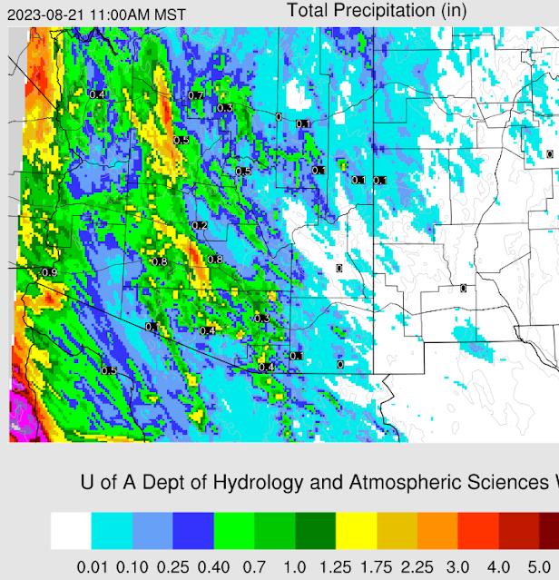
Current NWS forecast keeps high POPs through the next seven days - forecast above covers through the weekend. Forecast below is from the 06 UTC WRF-GFS and shows total precipitation through 11:00 am on Monday the 21st. Looks like a very interesting weather weekend!


No comments:
Post a Comment