
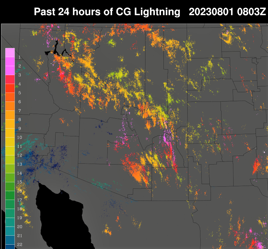
Heavy thunderstorm over our part of town in this view from campus at 6:20 pm MST yesterday evening. Plot of detected CG flashes (from Atmo and Vaisala) for 24 hours ending at 0803 UTC (1:03 am) shows that thunderstorm activity this part of Arizona was concentrated over eastern Pima County.

Rainfall observations from the ALERT network for 24 hours ending at 7:00 am this morning (above and below) show that the event affected mostly the northern portion of the network. Nine sites recorded over half an inch of rain. Here at the house we had 0.34" with estimated gusts to around 50 mph; the airport had 0.75" with a severe gust to 58 mph; DM reported reported gusts to 41 mph with 0.41" inches of rain; Marana reported a severe wind gust to 73 mph (amount of rain not reported).


No comments:
Post a Comment