
We've been away on trip around parts of the Southwest last few days and came back into Tucson at midday yesterday along I-10 from the east. We came across southwest New Mexico and Cochise County before any thunderstorms developed, but visible satellite image for 2330 UTC yesterday afternoon indicates widespread thunderstorm activity along the Continental Divide. Plot below shows CG flashes detected (from Atmo and Vaisala) for 12-hours through 06 UTC this early morning - quite impressive amount of thunderstorm activity, but none yet toward the GoC, although storms over Cochise County were west of Divide. However, next two weeks will be very interesting.

Moisture sloshing around and recycled via storms and outflows continues chances for activity over Cochise County and perhaps into eastern edges of Pima County. The forecast for precipitation below (from 06 UTC WRF-GFS run at Atmo on 1.8 km grid) is through the period ending 6:00 am MST on the 10th (Sunday). The light rainfall amounts, indicate high potential for wildfires due to dry lightning.


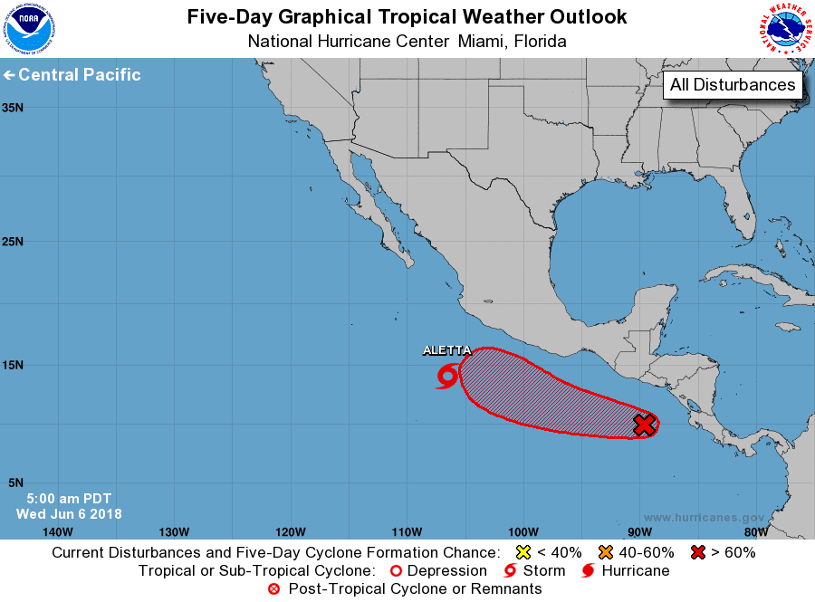
Meanwhile, TS Aletta has developed over the eastern Pacific. This morning's NHC forecast (above) indicates that Aletta will become a hurricane and stay far southwest of Baja. The five day outlook (below) indicates that Bart may develop right behind Aletta. The operational GFS forecasts Aletta on a track considerably north of that shown above. As a result, the GFS forecasts a strong push of tropical moisture up the GoC. The PW forecast at bottom is from the 00 UTC WRF-GFS on the 5.2 km grid. This would certainly be an early push of serious low-level moisture into southern Arizona. Something to watch - I also note that the operational GFS is a wet outlier wrt the GEFS runs, pushing PW at Tucson higher than almost all of the ensemble members. But, finally much to watch as the mid-level pattern definitely is beginning to look more like July than June.


No comments:
Post a Comment