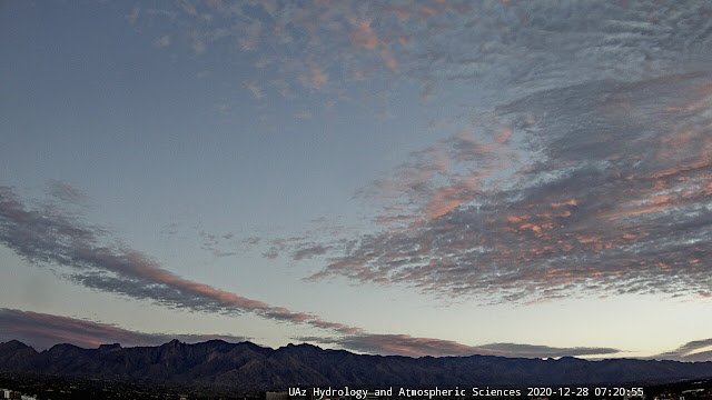
Bit of color before sunrise this morning. Down at bottom are views of Catalinas yesterday, and of stacked lenticular clouds downwind of Mt. Rainier in Washington.
The large, closed low at 500 mb off California is forecast to open up and shear to the northeast as it comes across the Southwest. Above is 500 forecast, valid at 7:00 am on the 30th, from the 06 UTC WRF GFS run at Atmo. Note the very cold temperatures, approaching -30 C, as trough crosses Arizona.
Numerous hazards across US next 24 hours (above) associated with the trough: pink areas have winter storm warnings , purple areas are under winter weather advisories, and dark brown area over Arizona is a strong wind advisory. See weather.gov for additional details.
The 06 UTC WRF GFS forecast for 10-m winds, below valid at 2:00 pm MST today, shows the strong winds forecast for Rim Country and northeast Arizona, but also forecasts equally strong, mountain-associated, winds here in southeastern Arizona.
The QPF plumes for rainfall at the airport, also from 06 UTC, above indicate nearly 100 percent chances for measurable rain at the airport tonight and tomorrow. As for precipitation with the system, the same WRF nighttime run forecasts light rain and mountain snow over much of eastern Pima County (below), but nothing at the airport. That forecast also indicates very cold temperatures across metro area for the morning of Wednesday the 30th, second below - valid at 7:00 am. So considerable changes in store next couple of days.


No comments:
Post a Comment