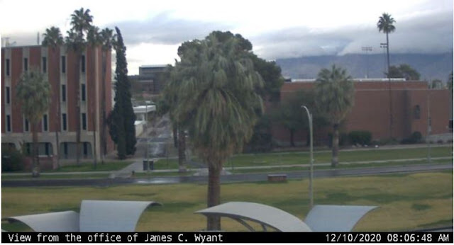
After a month of dryness here at house, we finally had some early morning rain and showers. Activity began around 2:00 am MST and had ended by 6:00 am here - amount here has been 0.20". Not much, but most for an event since July 23rd!
Image down at bottom shows a wet rush hour in Phoenix area this morning.
ALERT measurements (north part of network above and south below) indicate essentially 100 per cent areal coverage, but with only a few sites receiving over a quarter of an inch. Second plot below shows rainfall measured at NWS and RAWS sites for all of southeast Arizona - amounts were heaviest across Cochise County, with the RAWS at Carr in the Huachuca Mountains recording nearly an inch.
There were some embedded thunderstorms (detected CG flashes above for 24-hours ending at 7:00 am this morning - from Atmo and Vaisala) - especiaally out in central Pima County. Gila Bend and Luke AFB, near Phoenix, both reported thunderstorms.
At 500 mb the low is still closed and centered over Yuma at 12 UTC this morning. Model forecasts are now taking the system across Arizona to our north today - which will bring in drier air by afternoon.
The 06 UTC GEFS plumes for QPF at airport indicate precipitation at airport essentially over by a bit after noon. However, the new 12 UTC WRF-NAM forecast (below) for total rainfall through 5:00 pm today, indicates only a bit more rain for the northwest corner of the metro area.


No comments:
Post a Comment