Catalinas before sunrise this morning above - at bottom is pre-dawn view of Orion over the Rincons.
Yesterday was a very active storm day for all of Arizona. Plot of detected CG flashes for 24-hours ending at 0103 am MST this early morning (above, from Atmo and Vaisala) shows widespread thunderstorm activity across entire state. There were 9 reports of severe wind gusts in Arizona yesterday - 3 in Tucson area and 6 in Phoenix area (probably some others between here and there that were not reported).
ALERT data (above and below for 24-hours ending at 6:00 am) show nearly all sites had 0.04" or more yesterday, with quite a few reports of half an inch to more than an inch. Here at house we had 0.24" during a mid-afternoon storm; the airport reported 0.08"; DM had 0.50" with a near severe gust to 56 mph about 2:00 pm; and Atmo reported 0.15". It was quite a significant storm day for the entire metro area!
This morning the upper tropospheric anticyclone is centered about over Lubbock, Texas (as per 250 mb analysis above). There is a hint of a weak inverted trough to our east.
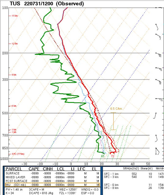
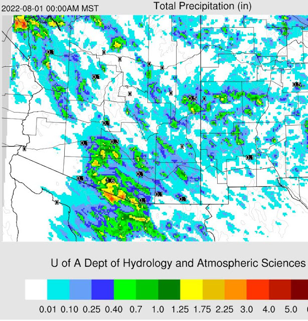
The 12 UTC TWC/TUS sounding (above) reflects the worked-over state of the atmosphere, after yesterday's activity. If I mix out BL to 700 mb, there appears to be little or no CAPE available for storms this afternoon. The 09 UTC run of the WRF-RR at Atmo somehow develops CAPE, and the forecast of precipitation through midnight is shown below. This, to me, appears to be too much storm activity over eastern Pima County, given that the day following an active event, as per yesterday's, is usually quite suppressed.


No comments:
Post a Comment