
Multiple contrails over the Catalinas just before sunrise (which was at 6:15 am MST) this morning.
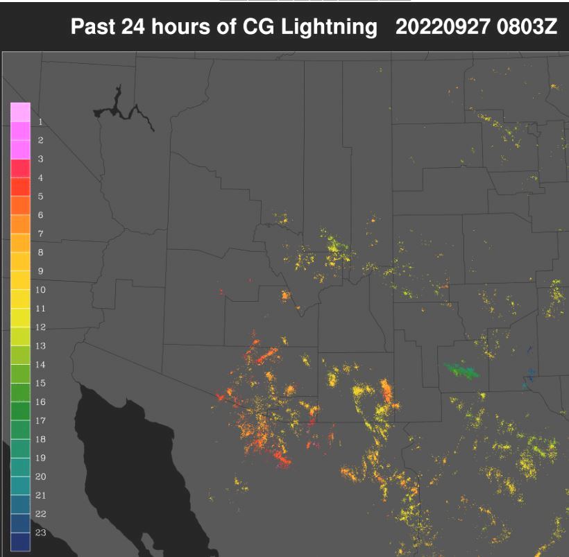
Plot of detected CG flashes (from Atmo and Vaisala) above is for 24-hours ending at 1:03 am early this morning. There was considerable increase in thunderstorm activity over southeast Arizona compared to Sunday. This was a surprise to me, given the morning sounding - see yesterday morning's post. There was a bit of a donut hole centered over the airport.
The ALERT network (two graphics below) had no rainfall reports over the metro area, but there were reports over Redington Pass area and south to west of the City. Note several reports over half an inch, with two reports over an inch. Nothing here at house.


The 500 mb analysis (above) remains a mess with the weak winds and height gradients. The sounding appears even more stable today (below from NCAR RAP). There are strong east winds below 800 mb again today.


I missed the gusty winds yesterday - the airport reported a gust to 33 mph. The 12 UTC WRF-RR forecast for winds at 9:30 am (above) indicates another windy morning. The same WRF forecast run predicts almost no rainfall across all of Arizona through midnight tonight, which looks reasonable to me.

No comments:
Post a Comment