
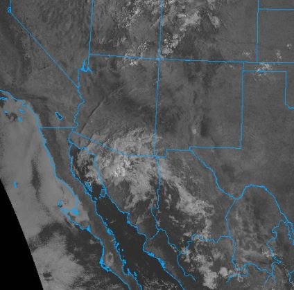
Heavy clouds brought a dreary morning here in Tucson. The cloudiness covers a large portion of southeast Arizona and northern Sonora, as per visible satellite image below - from 8:15 am MST.

Plot of detected CG flashes (above from Atmo and Vaisala) shows thunderstorms occurred yesterday afternoon across Pima and Santa Cruz Counties, with nothing to their east. Note that almost nothing mentioned in yesterday's post verified well.


The morning 500 mb analysis (above - from NCAR RAP) shows that the cloudiness shown above is associated with an inverted trough over Arizona and Sonora. This feature will be slow to move out, bringing continued chances for showers through the weekend, as per am forecast from TUS Forecast Office below.
The current NHC forecast for Hurricane Ian, now off the east coast of Florida, is shown second below.


No comments:
Post a Comment