
Scattered middle clouds at sunrise this morning.

Conditions changed enough during day yesterday to support development of thunderstorms over parts of southern Arizona. There was even a distinct band of CG flashes northwest of metro area, as per plot of detected flashes above for 24-hours ending at midnight last night (from Atmo and Vaisala). The forecasts from NWS and the WRF model shown in yesterday's post verified quite well.

Reports for the ALERT network (above and below for 24-hours ending at 6:00 am MST this morning) show patchy coverage, concentrated mostly in north part of network. Airport and DM reported thunder but only traces of rain; while Atmo had 0.01" and we had 0.02" here at house. There were five reports of half an inch or more. The report of more than 4 inches west of Picture Rocks is obviously bad; a nearly co-located MesoWest site had only 0.12".


This morning the remnants of Kay are centered southwest of San Diego with no deep convection, as per IR image above from 1320 UTC this morning.
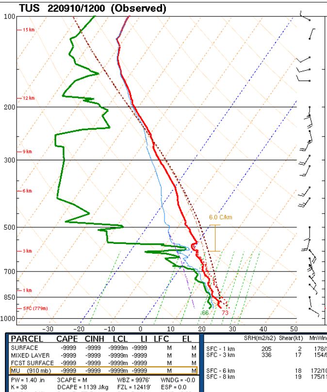
The morning TWC/TUS sounding (plot above from SPC) has only a sliver of afternoon CAPE (ignore the unrealistic lifted parcel analysis). The 06 UTC WRF-GFS forecast indicates PW falling from 1.40" to about an inch by mid-afternoon. That model run forecasts almost no rainfall across all of southern Arizona through midnight tonight (below).
First rainfall event in over two weeks was welcome, even with its spotty nature.

No comments:
Post a Comment