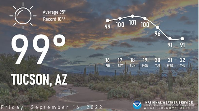
Clear skies over the Catalinas and southern Arizona at 8:00 am MST this morning. Graphic below shows NWS forecast high temperatures for next seven days.
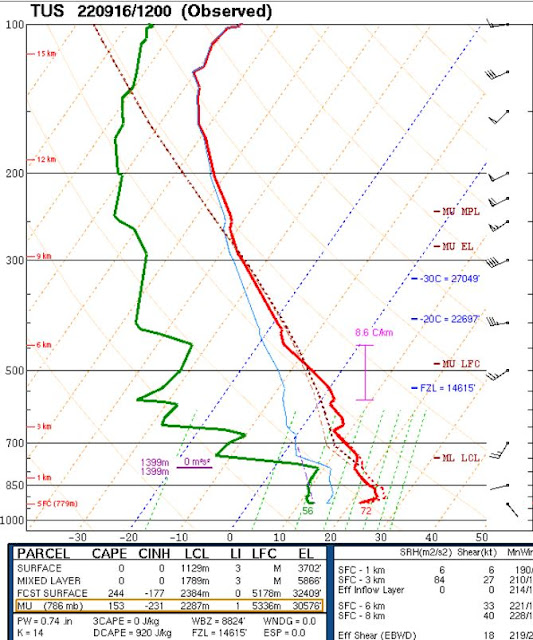
The morning sounding for TWC/TUS (above) is quite dry (PW 0.74") and stable, with westerly winds through the troposphere.
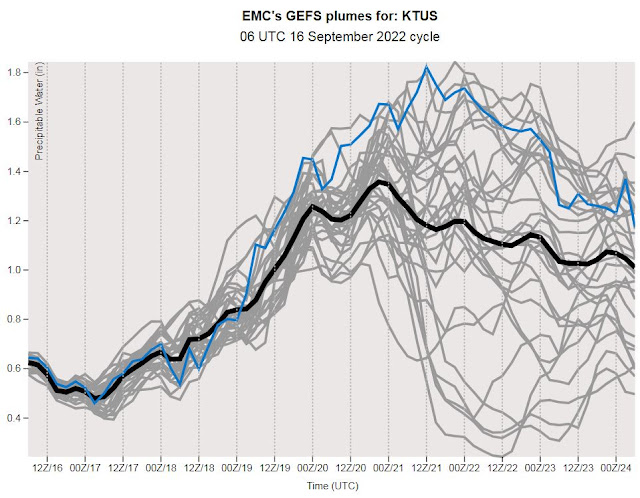
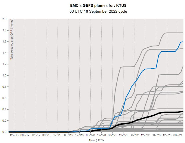
The 06 UTC GEFS plumes for PW (above) show even lower values by this evening, followed by a slow rebound. Below are the plumes for QPF at airport from same model runs. Note the huge variance among the plumes from the ensemble members beginning around next Tuesday. The operational GFS (blue) goes VERY wet starting Tuesday afternoon. However, all of this is four days and more from now.
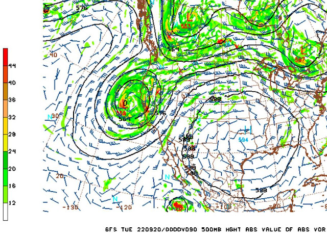
The 500 mb morning analysis (above) shows a broad trough over western half of US and a small anticyclone to our southeast.. However, the GFS 06 UTC 500 mb forecast (below) shows significant changes by 5:00 pm Monday afternoon, with trough along west coast and a huge anticyclone centered over northeast corner of Texas.
To the south, there's a TS/Hurricane near Baja - however, this not "Lester" as mentioned in previous posts. TS Lester developed early today, but is expected by NHC to dissipate over western Mexico on Sunday. So the storm in this forecast would be "Madeline".


No comments:
Post a Comment