
Storms moving toward the eastern Catalinas at about 5:00 pm MST yesterday afternoon.

Plot of detected CG flashes (from Atmo and Vaisala) for 24-hours ending at 0703 UTC last night shows there were several active clusters of storms in eastern Pima County.

ALERT rainfall through 7:00 am is shown above. Some heavy storms did come into the metro area. Here at the house we had thunder, but only light sprinkles amounting to a Trace.

The 500 mb analysis at 12 UTC this morning (above from SPC) shows the large anticyclone is centered over the Colorado - New Mexico border. note the 5980 m height at Albuquerque. The TWC/TUS sounding is again missing this morning.

Forecast TUS sounding (above from 12 UTC WRF-HRRR) indicates considerable CAPE at 4:00 pm this afternoon. The forecast from the same model run for rainfall through midnight tonight is shown below - very heavy area of rain in the forecast is mostly west of the metro area.

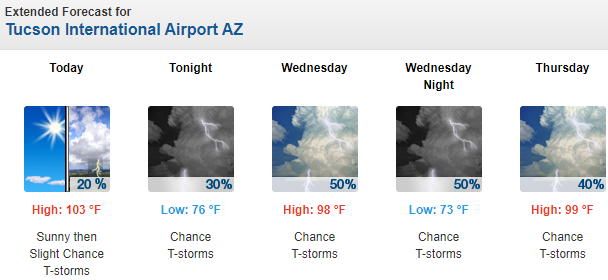
Current NWS forecast for the airport is shown below.
No comments:
Post a Comment