
View of the Catalinas around 5:20 am MST this morning.

Plot of detected CG flashes through 0703 UTC last night (from Atmo and Vaisala) shows some ongoing activity over portions of eastern Pima County. ALERT plot (below through 6:30 am this morning) shows some rainfall, mainly in southern portions of the network. Nothing here at the house overnight.


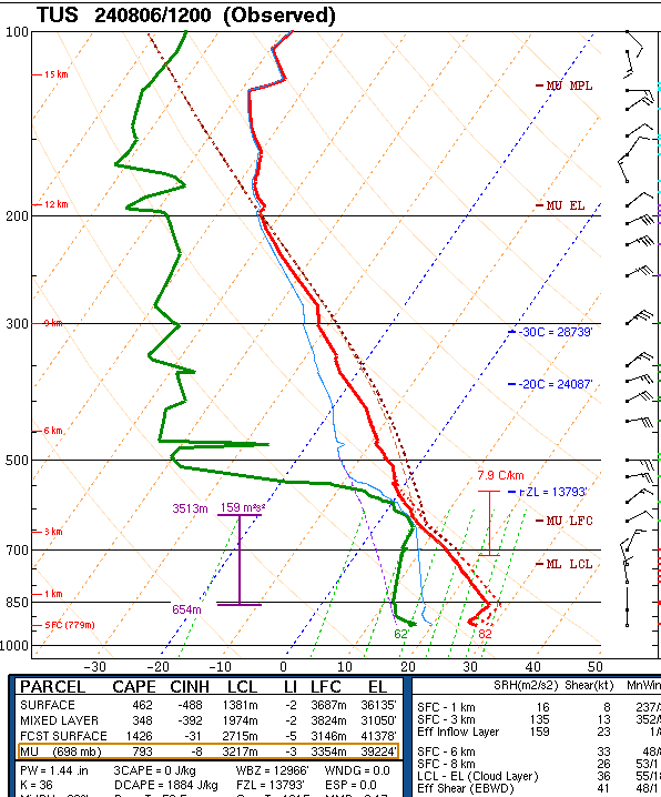
The 500 mb analysis this morning (above, from SPC) indicates an inverted trough just to our east, from western New Mexico south to southern Sonora. The morning TWC/TUS sounding (below, also from SPC) indicates some CAPE, with winds above 700 mb basically from the east at up to 35 kts. Any storms today should move rapidly westward.

Morning outlook from the TUS Forecast Office shows chance for severe thunderstorm winds and also heavy rains - note that product is a bit more legible on the NWS webpage.

Forecast from the 12 UTC run of the WRF-HRRR at Atmo (above) forecasts some storms along and west of I-10 through midnight tonight. Current NWS forecast for the airport (below) indicates POPs as high as 70 % this evening.

No comments:
Post a Comment