Bit of color over the eastern Catalinas at about 6:00 am MST this morning.
Plot of detected CG flashes through 6:00 am (below - from Atmo and Vaisala) shows only a few flashes in all of eastern Pima County yesterday afternoon. Heard rumbles of thunder here from strikes in the foothills to north - but not even a sprinkle of rain fell.
Only six sites in the ALERT network observed rainfall through 6 am (above). Amounts were light, with heaviest being only 0.12" near Mt. Lemmon.
At 500 mb (above from SPC) The large anticyclone center is now over southern Illinois, with perhap a second, weak center over lower Colorado River. There is a closed, upper-tropospheric low over south Texas (not an easterly wave as per recent NWS forecast discussions). Winds at 500 are very weak over the entire southwest US.
The 06 UTC run of the WRF-GFS at Atmo (below) indicates some scattered, light showers in eastern Pima County by midnight tonight.
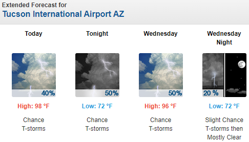
Morning graphic (above from NWS) with current forecast below - NWS forecasts considerable more storm activity than does the WRF.


No comments:
Post a Comment