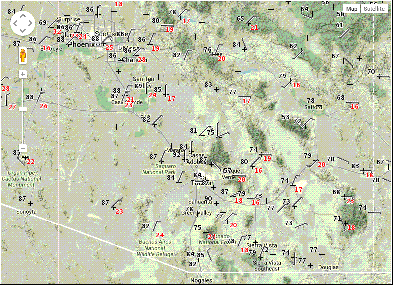
The NWS has issued several alerts for winds and and fire danger for tomorrow. The grid point forecast for TUS (the airport) includes wind gusts as high as 48 mph tomorrow morning. The current (3 pm MST) MesoWest surface plot (below with wind gusts shown in red) shows that right now the Tucson metro area is in a zone of light winds, but with gusty conditions nearly surrounding us.
Mike Leuthold sent this visible satellite image from Sunday morning - it is just before the dust cloud moved in around 9 am MST. The dust cloud was very large, stretching across the entire state - I've added dashes around the area where the dust is easily seen. The dust apparently had its origins over the southern California deserts, the lower Colorado Basin, and southwestern Arizona.
Tuesday, May 13, 2014
Subscribe to:
Post Comments (Atom)


No comments:
Post a Comment