Buildups to the east before sunrise this morning (Saturday, 20 July).
ALERT observations for 24-hours ending at 7:00 am MST this morning (above and below) show scattered rainfall reports here and there across our region.
Here at house we had a brief shower between 5 and 6 pm that left 0.06" in the gauge. TUS and DM both had a Trace, while data from Atmo remain missing.
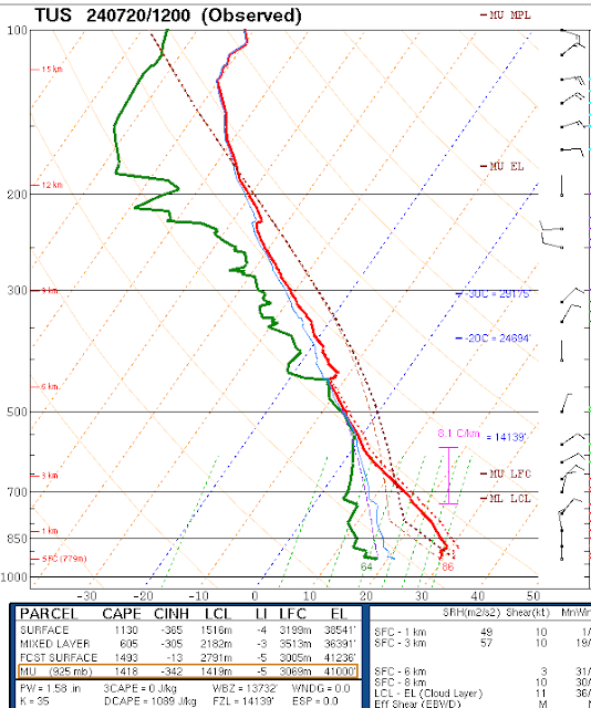
At 500 mb (above from SPC) the large anticyclone covers the West with main center over southwest Arizona. Winds are mostly light around this feature. The morning sounding from TWC/TUS (below - also from SPC) shows over an inch and a half of precipitable water (PW), but with a deep, surface-based dry layer left behind by yesterday's storms. Again, it will be interesting to see if afternoon heating will be able to get storms going. Winds aloft are light and variable with no steering flow of note.
Forecast above from the 12 UTC WRF-RR shows forecast rain amounts through 6:00 am tomorrow morning. The NWS morning forecast, along with a special statement, are shown below. The legend at lower right of statement is unreadable, but it appears to indicate slight risk, when I use a magnifying glass.


No comments:
Post a Comment