Morning color over the eastern Catalinas at about 5:30 am MST this morning.
Base scan radar (above from 0320 UTC last evening) shows storms that moved south and west from the Catalinas over our part of town.
ALERT plots (above and below for 24-hours ending at 7:00 am this morning) show that a number of sites had over an inch of rainfall. Here at house we had 0.11" with wind gusts of 50 to 60 mph (estimated); the airport reported 0.57" with gusts to 47 mph; DM had 0.88" with gusts to 48 mph; and Atmo had gusts to 40 mph (rain gauge there is out-of-service). Winds here destroyed our front gate, which, although very old, had lasted through everything for 27 years.
At 500 mb (above) the anticyclone center has shifted out to western Arizona and forecasts indicate that it will drift northward over the Great Basin for the next week or so.
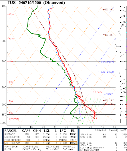
The morning sounding from TWC/TUS (below) shows a classic onion shape, that will require substantial heating to overcome the deep, cool surface layer left behind by last evening's storms. Winds aloft are mostly light and variable below 200 mb.


No comments:
Post a Comment