The setting full-moon at 5:30 am MST this morning.
Plot of detected CG flashes for 24-hours ending at 0723 UTC last night (above from Atmo and Vaisala) shows that there were thunderstorms yesterday across much of Arizona and northern Mexico.
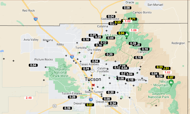
ALERT plots (above and below) show a large number of reports of rainfall across the region for 24-hours ending at 7:00 am this morning. While we had some rumbles of thunder, there was no rain here at the house.
There were quite a few severe wind reports scattered across Arizona yesterday (see SPC webpage), with several occurring around the Tucson area. I was inside and don't have a wind speed estimate for here. TUS had 0.10" of rain with gusts 51 mph, and DM reported 0.35" of rain with gusts to 44 mph.
The ridge continues over the West, with anticyclone circulation centers near the west coast of California and southern Idaho (analysis above from SPC).
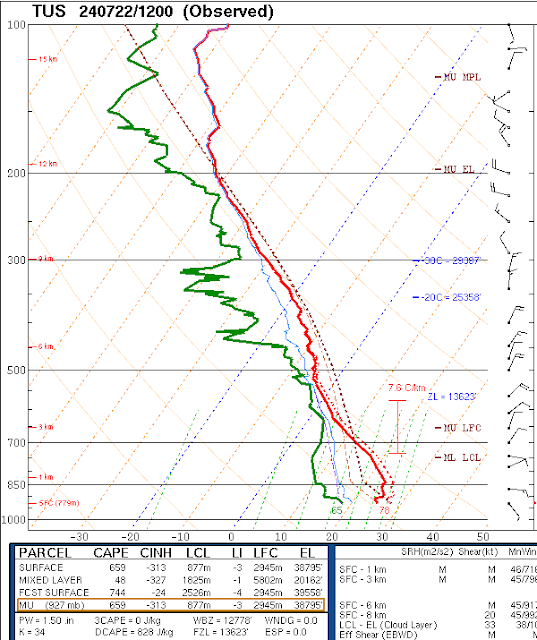
The 12 UTC upper-air sounding (below, also from SPC) has 1.50" of PW, but continues with a fairly dry, surface-based layer that reaches nearly to 600 mb. Steering winds aloft are near 20 kts from the north-northeast.
The 06 UTC WRF-GFS forecast (above, valid through noon tomorrow) indicates much diminished activity over Arizona today. This is reflected in the current NWS Forecast Office morning forecast for the airport (below).


No comments:
Post a Comment