Sunrise, with some contrail, looking toward Redington Pass at 6:00 am MST this morning.
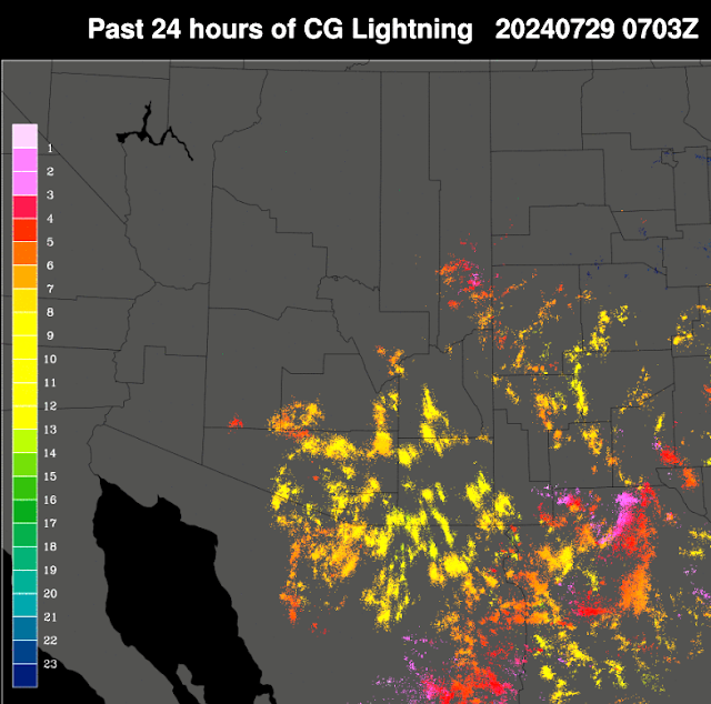
Plot of detected CG flashes (from Atmo and Vaisala) for 24-hours ending at 0703 UTC last night. There was considerable thunderstorm activity across eastern Pima County. Much rumbling thunder here after 4:00 pm or so.
However, there was only a very light evening shower that left only 0.02" in the gauge. The airport had 0.04" and DM had 0.06", while Atmo remains out-of-service. ALERT network data (above and below - for 24-hours ending at 7:00 am this morning) show scattered sites with rain across entire network. There were a few sites with over half an inch, as well as two spots in the Catalinas with over an inch.
At 5oo mb (above) the anticyclone has shifted well eastward and is now centered over west Texas. The morning TWC/TUS sounding (below) continues to be onion-shaped, but with considerable PW and BL CAPE. Winds aloft continue light and mostly from the south below 200 mb.
The 12 UTC run of the WRF-RR forecasts almost no rain across all of Pima County through midnight tonight (above from Atmo). The current NWS morning forecast below for the airport is a bit more optimistic. Given all the activity yesterday, I'd vote for a mostly down day.


No comments:
Post a Comment