
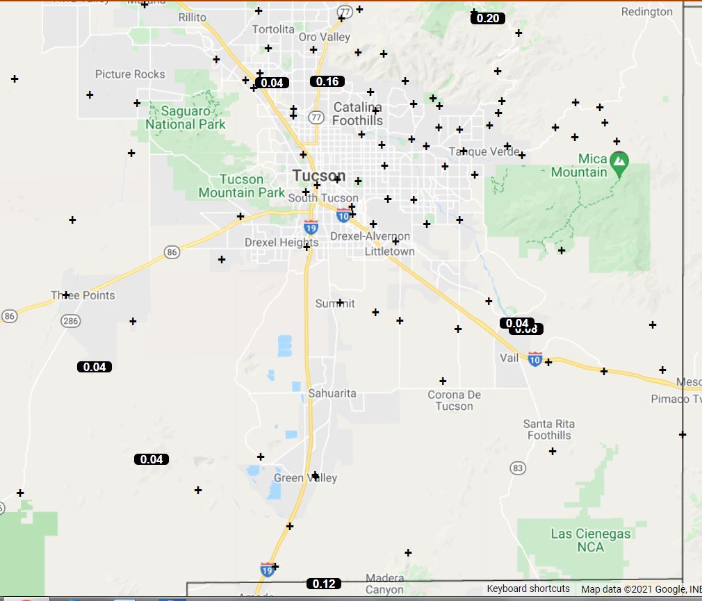
Yesterday was mostly suppressed over much of Pima County as per plot of detected CG flashes (below) for 24 hours ending at 1:00 am early this morning. However, there was one lonely flash in the metro (hard to see) from the storm shown above. The flash produced a grumble of thunder here at the house about 5:30 pm MST. The WRF forecast prevailed in yesterday's dueling forecasts (see previous post). There were only 8 reports of rainfall across the ALERT network, and those reports were widely scattered (second below).


The TUS/TWC morning sounding (above) has a strange dual residual BL structure. Moisture is down a bit, but CAPE is up and steering flow appears to be easterly from 10 to 20 kts. The 300 mb forecast (below - from 06 UTC GFS 16 August runs valid at 06 UTC tonight) shows the southwestern end of a very elongated trough across Arizona. This feature is moving slowly southward in the forecasts.


Ahead of the upper trough thunderstorms are forecast to develop over much of southeastern Arizona (forecast of radar echoes above from 12 UTC WRF-RR this morning - valid at 8:00 pm this evening). Forecast for total rainfall through 6:00 am tomorrow morning (below, from same model run). Looks like an interesting event, with the possibility of severe thunderstorms across parts of the metro area.

No comments:
Post a Comment