Clear skies continue at 7:56 am MST this morning. Lightning plot below (from Atmo and Vaisala) shows little thunderstorm activity over Arizona yesterday, but there were several, isolated storms over southeast portion of state.
SkewT plot for this morning's sounding (above - from SPC) is quite impressive with substantial CAPE. Thunderstorms are likely, but the southeasterly flow through the troposphere suggests that anvils could spread ahead of storm cores, shading the surface. The 06 UTC WRF-GFS (below) forecasts a line of strong echoes over parts of metro area at 7:30 pm this evening, as well as more significant activity over Cochise County. Note that the forecast does indeed forecast anvils spreading ahead of the storms - a negative aspect of today's setting.
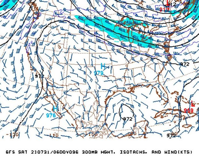
Looking ahead toward the weekend, the situation in the upper troposphere is very interesting. A closed low at 300 mb is centered south of Brownsville, Texas, and is forecast to head our way. The two forecasts below show the low over northern Mexico at 48 hours, and then nearly over Tuscon on Friday evening, but also much weakened by then.
Bit of commentary - forecast discussions from NWS Tucson have been referring to this features as an "easterly wave." Such waves have their strongest winds in low-levels - certainly not the situation with this upper low. Brownsville sounding this morning shows strongest winds with the low are up around 250 mb, so it's definitely not an easterly wave.


No comments:
Post a Comment